Login

Zapomniałeś swój login?

Cookies have to be accepted!
Your browser's cookie functionality is disabled. Please enable this functionality.

Not a member yet?

Register now
Login

Available for registred users only

Log in to use this feature.

Zapomniałeś swój login?

Cookies have to be accepted!
Your browser's cookie functionality is disabled. Please enable this functionality.

Not a member yet?

Register now
Filter
Kategorie
Advanced filters
  • Długość (km)
  • Wysokość
Zapisz filtr Reset filter

TrackRank

QRCode

Technical data

Długość19,6 km Wysokość1057 m Way down2439 m Czas trwania00:00 h:m Data01.12.2017
Oceny Author Krajobraz Czynnik zadowolenia Kondycja Technika

Statystyka

160 Widoki Oceny 9 Downloads / Pliki do pobrania Przeciętnie
Rate
  • Karta trasy
  • Dojazd
  • Downloads / Pliki do pobrania
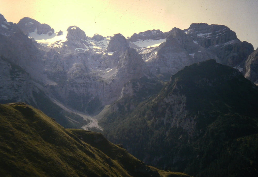
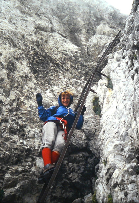
Attaversata lunga e impegnativa con passaggi su neve e una ferrata (Ettore Castiglion)i da fare in discesa poi lunga discesa in Val Ambiez  fatta nel 1983

Galeria trasy

Mapa trasy i profil wysokości

  • Open Street Map
  • Google
Minimum height 713 m Maximum height 2823 m Widok szczegółowy

More about the tour author

bettoliroberto
Member since 2010

Send private message

Komentarze

GPS tracks

Trackpoints
  • GPX / Garmin Map Source (gpx) download
  • TCX / Garmin Training Center® (tcx) download
  • CRS / Garmin Training Center® (crs) download
  • Google Earth (kml) download
  • G7ToWin (g7t) download
  • TTQV (trk) download
  • Overlay (ovl) download
  • Fugawi (txt) download
  • Kompass (DAV) Track (tk) download
  • Karta trasy (pdf) download
  • Original file of the author (gpx) download

More about the tour author

bettoliroberto
Member since 2010

Send private message
Share track
Add to my favorites
Remove from my favorites
Edit tags
My score
Rate
Trasa: Attraversata Dos de Sabion SAn Lorenzo in Banale
Rodzaj: Trasy górskie
Długość: 19,6 km
Evaluated on:
Czas trwania:
Day(s)
Hour(s)
Minute(s)
Ocena: Krajobraz Czynnik zadowolenia Kondycja Technika