


Die Tour beginnt beim Campingplatz Aqua Dolce.
Wer diese Route fahren möchte sollte sich darüber im klaren sein, dass das Bike hin und wieder über diverse Steine zu tragen ist. Auch gibt es eine etwas längere Strecke, die nur mit Klettern zu bewältigen ist.
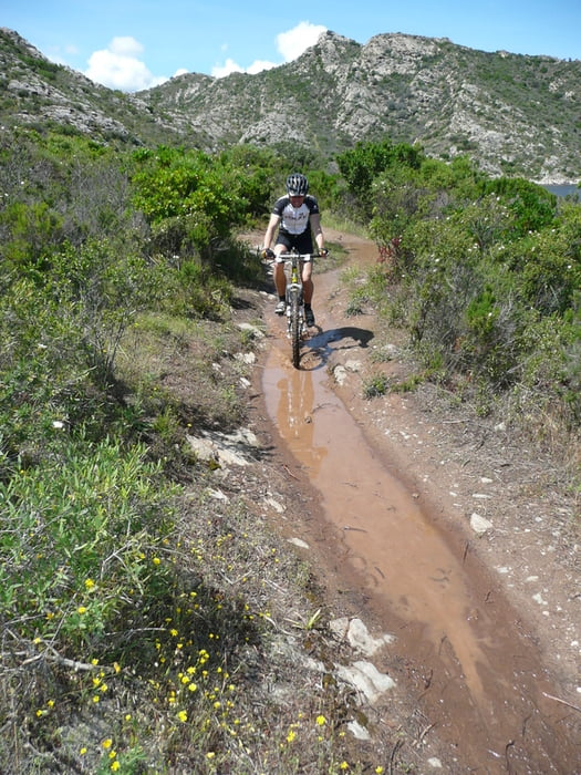
Meine Frau und ich haben die Tour zwei Tage nach heftigsten Regenfällen gemacht. Deshalb mussten wir insgesamt 6 Flüße durchqueren; teilweise reichte uns das Wasser bis zum Gesäß.
Waren aber trotz allem begeistert.
Wer diese Route fahren möchte sollte sich darüber im klaren sein, dass das Bike hin und wieder über diverse Steine zu tragen ist. Auch gibt es eine etwas längere Strecke, die nur mit Klettern zu bewältigen ist.
Meine Frau und ich haben die Tour zwei Tage nach heftigsten Regenfällen gemacht. Deshalb mussten wir insgesamt 6 Flüße durchqueren; teilweise reichte uns das Wasser bis zum Gesäß.
Waren aber trotz allem begeistert.
Galeria trasy


Mapa trasy i profil wysokości
Minimum height -9 m
Maximum height 285 m
More about the tour author

|
Komentarze
GPS tracks
Trackpoints-
GPX / Garmin Map Source (gpx) download
-
TCX / Garmin Training Center® (tcx) download
-
CRS / Garmin Training Center® (crs) download
-
Google Earth (kml) download
-
G7ToWin (g7t) download
-
TTQV (trk) download
-
Overlay (ovl) download
-
Fugawi (txt) download
-
Kompass (DAV) Track (tk) download
-
Karta trasy (pdf) download
-
Original file of the author (gpx) download
More about the tour author
|
|
Add to my favorites
Remove from my favorites
Edit tags
Open track
My score
Rate
Crosing the river Santu
Best regards Janja.
Küstenabschnitt
wir sind vor 3 Wochen die Strecke gefahren, oder sollte ich besser sagen wir haben die gesamte Küste das Rad getragen und geschoben.80% unfahrbar.
Dabei gab es Abschnitte die sehr gefährlich waren.
Ein Fehler hätte zu Klippenstürzen von 5 Meter und mehr führen können.Um diesen gefährlichen Kletterpassagen auszuweichen muss man über die Historische Signalstation am Phare de Mortella
gehen.Nicht unten dem Küstenpfad folgen.
Gruß
Christian
Ps:Besser eine eigene Touren planen.