Login

Zapomniałeś swój login?

Cookies have to be accepted!
Your browser's cookie functionality is disabled. Please enable this functionality.

Not a member yet?

Register now
Login

Available for registred users only

Log in to use this feature.

Zapomniałeś swój login?

Cookies have to be accepted!
Your browser's cookie functionality is disabled. Please enable this functionality.

Not a member yet?

Register now
Filter
Kategorie
Advanced filters
  • Długość (km)
  • Wysokość
Zapisz filtr Reset filter

TrackRank

QRCode

Technical data

Długość68,0 km Wysokość1305 m Way down1276 m Czas trwania00:00 h:m Data01.05.2018
Oceny Author Krajobraz Czynnik zadowolenia Kondycja Technika

Statystyka

214 Widoki Oceny 17 Downloads / Pliki do pobrania Przeciętnie
Rate
  • Karta trasy
  • Dojazd
  • Downloads / Pliki do pobrania
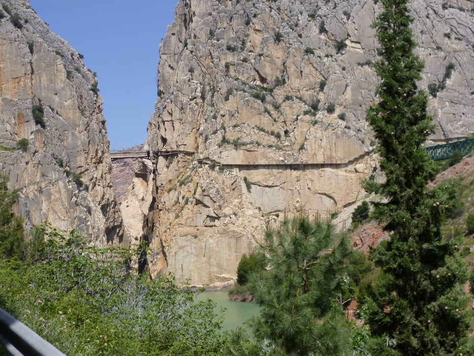
Von Pizarra über Nebenstraßen nach El Chorro, Ausgang des Caminito del Rey, weiter die Straße Richtung Ardales. Über Schotterstraßen den Bergrücken erklommen und nach Carratraca bergab. Zurück nach Pizarra über die Straße nach Alora.

Mapa trasy i profil wysokości

  • Open Street Map
  • Google
Minimum height 93 m Maximum height 664 m Widok szczegółowy

More about the tour author

bernd_brinck
Member since 2011

Send private message

Komentarze

GPS tracks

Trackpoints
  • GPX / Garmin Map Source (gpx) download
  • TCX / Garmin Training Center® (tcx) download
  • CRS / Garmin Training Center® (crs) download
  • Google Earth (kml) download
  • G7ToWin (g7t) download
  • TTQV (trk) download
  • Overlay (ovl) download
  • Fugawi (txt) download
  • Kompass (DAV) Track (tk) download
  • Karta trasy (pdf) download
  • Original file of the author (gpx) download

More about the tour author

bernd_brinck
Member since 2011

Send private message
Share track
Add to my favorites
Remove from my favorites
Edit tags
My score
Rate
Trasa: El Chorro
Rodzaj: Rower górski (MTB)
Długość: 68,0 km
Evaluated on:
Czas trwania:
Day(s)
Hour(s)
Minute(s)
Ocena: Krajobraz Czynnik zadowolenia Kondycja Technika