Giro dei Monti Sibillini
Traum-Runde im Monti Sibillini Nationalpark auf guten und verkehrsarmen Straßen.
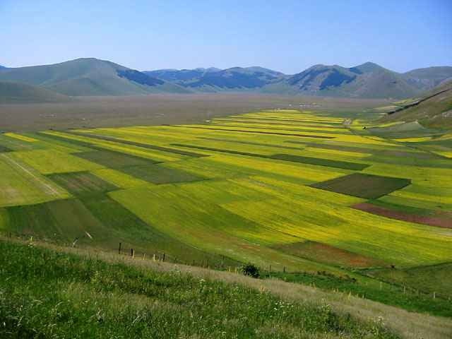
Neben dem Lago del Fiastrone (Baden!) ist der "Piano Grande" von Castelluccio di Norcia das absolute Highlight der Tour. Es ist ein unvergleichliches Erlebnis, wenn man nach über 2000 Höhenmetern die Passhöhe Forca di Presta erreicht und unvermittelt in eine weite, menschenleere und monumentale Hochebene blickt. Endlose Weiden und ein paar karge Äcker - kaum ein Baum steht in der knapp 8 km langen und 2–3 km breiten Ebene, die von kahlen Bergen eingerahmt wird, deren höchster Gipfel der Monte Vettore mit fast 2500 m ist.
Strecke: Pievebovigliana (440 m )- Lago del Fiastrone - Bolognola (1400 m)- Sarnano (500 m) - Amandola - Montemonaco - Balzo di Montegallo - Forca di Presta (1500 m) - Castellucio - Visso (600 m) - Taro - Fiordimente- Pievebovigliana.
Galeria trasy
Mapa trasy i profil wysokości
Minimum height 442 m
Maximum height 1521 m
Komentarze

Der Nationalpark der Monti Sibillini liegt im umbrisch-markischen Apennin nördlich der Abruzzen.
Tipp für Unterkunft - der Agriturismo www.lecastellare.it in Montemonaco. Man kann hier leicht 2 Wochen verbringen, um alle lohnenden MTB, Rennrad- und Bergtouren im Nationalpark zu genießen.
Tipp für Unterkunft - der Agriturismo www.lecastellare.it in Montemonaco. Man kann hier leicht 2 Wochen verbringen, um alle lohnenden MTB, Rennrad- und Bergtouren im Nationalpark zu genießen.
GPS tracks
Trackpoints-
GPX / Garmin Map Source (gpx) download
-
TCX / Garmin Training Center® (tcx) download
-
CRS / Garmin Training Center® (crs) download
-
Google Earth (kml) download
-
G7ToWin (g7t) download
-
TTQV (trk) download
-
Overlay (ovl) download
-
Fugawi (txt) download
-
Kompass (DAV) Track (tk) download
-
Karta trasy (pdf) download
-
Original file of the author (gpx) download
Add to my favorites
Remove from my favorites
Edit tags
Open track
My score
Rate


