


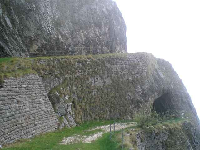
vom Parkplatz in Brentonico beginnt eine lange Auffahrt auf Asphaltstrasse (nicht stark befahren) nach San Giacomo und weiter nach San Valentino. Hier beginnt der interesssante Teil der Tour mit der Auffahrt zum Corno della Paura. Beim Schild "Attenzione Pericolo" weiter dem Weg folgen und durch grobn Schotter und einige Tunnels am Sentiero della Pace entlang (wenn man dem Weg folgt nie richtige gefährlich). Abfahrt auf Schotterwegen bis zu einer scharfen Rechtskehre (nicht Richtung Polsa, sondern einem Weg über Wiesen un durch den Wald folgend Richtung Saccone). Von dort aus die letzten paar Kilometer auf Asphalt zurück zum Parkplatz.
Galeria trasy
Mapa trasy i profil wysokości
Minimum height 667 m
Maximum height 1555 m
More about the tour author

|
Wilk |
Komentarze

mit dem Auto von Mori nach Brentonico bis zum Parkplatz am Ortsende
GPS tracks
Trackpoints-
GPX / Garmin Map Source (gpx) download
-
TCX / Garmin Training Center® (tcx) download
-
CRS / Garmin Training Center® (crs) download
-
Google Earth (kml) download
-
G7ToWin (g7t) download
-
TTQV (trk) download
-
Overlay (ovl) download
-
Fugawi (txt) download
-
Kompass (DAV) Track (tk) download
-
Karta trasy (pdf) download
-
Original file of the author (gpx) download
More about the tour author
|
|
Wilk |
Add to my favorites
Remove from my favorites
Edit tags
Open track
My score
Rate