

In Aigle gestartet fängt es bereits an zu tröpfeln.
Nass, kalt (für August) und grau - schon richtig herbstlich ist es.
Sehr schöne liebliche Gegend.
Man fährt die Rebberge hinauf und kommt immer höher.
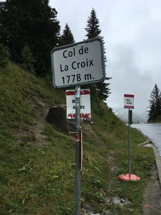
Der Anstieg zum Col de la Croix zieht sich aber ist sehr schön zu fahren, da der Anstieg ziemlich regelmässig ist. Kurze Pause auf dem Col, Bild von der 'Gipfel-Tafel', Aussich: grau! Gefühlte -5 Grad, in echt etwa plus 5 :-(
Hinunter nach Les Diablerets muss ich mich im nebligen Nass voll konzentrieren.
Kurz aufwärmen in einem gemütlichen Café bei einem thé verte bevors dann weitergeht auf den Col du Pillon.
Mapa trasy i profil wysokości
Minimum height 388 m
Maximum height 1780 m
More about the tour author
|
|
Lembleda |
Komentarze

Mit dem Zug bis Aigle, Start vom Bahnhof.
GPS tracks
Trackpoints-
GPX / Garmin Map Source (gpx) download
-
TCX / Garmin Training Center® (tcx) download
-
CRS / Garmin Training Center® (crs) download
-
Google Earth (kml) download
-
G7ToWin (g7t) download
-
TTQV (trk) download
-
Overlay (ovl) download
-
Fugawi (txt) download
-
Kompass (DAV) Track (tk) download
-
Karta trasy (pdf) download
-
Original file of the author (tcx) download
More about the tour author
|
|
Lembleda |
Add to my favorites
Remove from my favorites
Edit tags
Open track
My score
Rate