
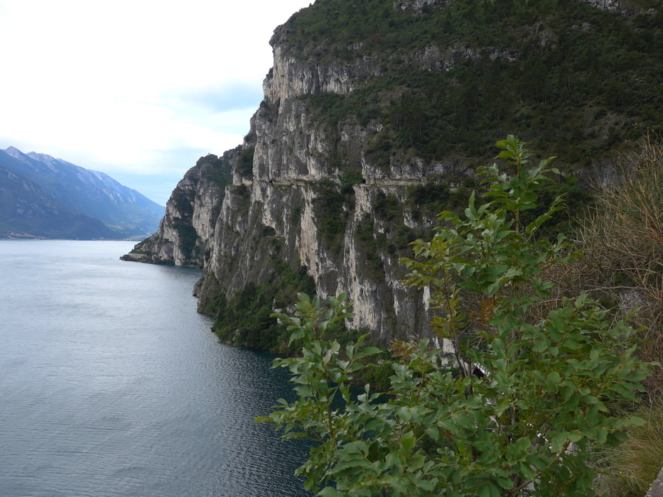

Von Riva del Garda sind wir Richtung Süden gefahren. Vor dem Autotunnel geht rechts die Straße weg nach Pregasina (nicht für PKW möglich). Eine meist geteerte Straße führt hinauf nach Pregasina. dann sind wir auf dem Wanderweg 422B Richtung Passo Rocchetta 1.150m geradelt, wobei wir das letzte Stück geschoben bzw das Bike getragen haben. Dann geht ein luftiger Pfad mit traumhaften Blicken auf den Gardasee bis zum Passo Guil 1.209m. Nach einem kurzen Trail geht es in den Wanderweg "101" hinein. Ein sehr anspruchsvoller, technisch nicht ganz einfacher Trail geht im Val di Sinogol hinunter und endet als steiler geteerter Weg in Limone.
Diese Tour ist mit ihren vielen Panoramablicken und dem langen Trail was ganz besonderes..
Galeria trasy


Mapa trasy i profil wysokości
Minimum height 67 m
Maximum height 1204 m
More about the tour author
|
|
Astrid_Steindl04 |
Komentarze

Von Riva del Garda geht es über Pregasina - Passo Rocchetta und Passo Guil nach Limone. Von dort sind wir mit der Fähre nach Riva zurück gefahren.
GPS tracks
Trackpoints-
GPX / Garmin Map Source (gpx) download
-
TCX / Garmin Training Center® (tcx) download
-
CRS / Garmin Training Center® (crs) download
-
Google Earth (kml) download
-
G7ToWin (g7t) download
-
TTQV (trk) download
-
Overlay (ovl) download
-
Fugawi (txt) download
-
Kompass (DAV) Track (tk) download
-
Karta trasy (pdf) download
-
Original file of the author (gpx) download
More about the tour author
|
|
Astrid_Steindl04 |
Add to my favorites
Remove from my favorites
Edit tags
Open track
My score
Rate