
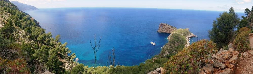

Vom Landgut Son Marroig hinab zur Halbinsel Sa Foradada und zur gleichnamigen Bar am Felsentor. Mir gefiel diese Rother Tour sehr gut, auch wenn sie kurz ist und sich Hin- und Rückweg decken. Aber ich bin eh ein Fan von Küstenwanderungen. Prächtige Fernblicke, grüne Kiefern vor tiefblauem, endlosem Meer, immer eine Brise, eine imposante Felsformation am Ziel und eine trubelige Bar (siehe Eindrücke im Google Fotos Link unten). Wenn man dort essen will, muss man vorher telefonisch reservieren. Einkehren lässt sich auch am Startpunkt.
Baby-Kinder-Hike: Breite Forstwege, die auch mit Kinderwagen zu bewältigen wären. Wir gingen mit Kraxe. Der steile Rückweg erfordert etwas Kondition.
Further information at
https://photos.app.goo.gl/XoSEP2D2RvJMTbDz6Galeria trasy


Mapa trasy i profil wysokości
Minimum height 14 m
Maximum height 291 m
More about the tour author
|
|
mackator |
Komentarze

Landgut Son Marroig
GPS tracks
Trackpoints-
GPX / Garmin Map Source (gpx) download
-
TCX / Garmin Training Center® (tcx) download
-
CRS / Garmin Training Center® (crs) download
-
Google Earth (kml) download
-
G7ToWin (g7t) download
-
TTQV (trk) download
-
Overlay (ovl) download
-
Fugawi (txt) download
-
Kompass (DAV) Track (tk) download
-
Karta trasy (pdf) download
-
Original file of the author (gpx) download
More about the tour author
|
|
mackator |
Add to my favorites
Remove from my favorites
Edit tags
Open track
My score
Rate