Login

Zapomniałeś swój login?

Cookies have to be accepted!
Your browser's cookie functionality is disabled. Please enable this functionality.

Not a member yet?

Register now
Login

Available for registred users only

Log in to use this feature.

Zapomniałeś swój login?

Cookies have to be accepted!
Your browser's cookie functionality is disabled. Please enable this functionality.

Not a member yet?

Register now
Filter
Kategorie
Advanced filters
  • Długość (km)
  • Wysokość
Zapisz filtr Reset filter

TrackRank

QRCode

Technical data

Długość53,0 km Wysokość1701 m Way down1705 m Czas trwania05:17 h:m Data04.07.2019
Oceny Author Krajobraz Czynnik zadowolenia Kondycja Technika

Statystyka

186 Widoki Oceny 72 Downloads / Pliki do pobrania Przeciętnie
Rate
  • Karta trasy
  • Dojazd
  • Downloads / Pliki do pobrania

Gatschach-bei Alm hinterm Brunn-Ostufer-Weißenbach-Bodenalm-

Naggler Alm-Hühnernock-Praditz-Gatschach

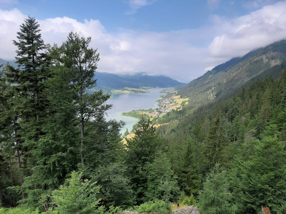
Schöne Weißenseerunde mit Überraschungsberg Hühnernock (die Schotterstraße rauf ist ganz neu und dementsprechend noch nicht in der Karte) - kann man, muss man aber nicht machen.

Ca 10 minütiges Bergabschiebestück nach dem Hühnernock.sonst ist alles gut zu fahren.

Galeria trasy

Mapa trasy i profil wysokości

  • Open Street Map
  • Google
Minimum height 906 m Maximum height 1506 m Widok szczegółowy

More about the tour author

mitter
Member since 2008

Send private message

Komentarze

Start und Ziel in Gatschach.

GPS tracks

Trackpoints
  • GPX / Garmin Map Source (gpx) download
  • TCX / Garmin Training Center® (tcx) download
  • CRS / Garmin Training Center® (crs) download
  • Google Earth (kml) download
  • G7ToWin (g7t) download
  • TTQV (trk) download
  • Overlay (ovl) download
  • Fugawi (txt) download
  • Kompass (DAV) Track (tk) download
  • Karta trasy (pdf) download
  • Original file of the author (gpx) download

More about the tour author

mitter
Member since 2008

Send private message
Share track
Add to my favorites
Remove from my favorites
Edit tags
My score
Rate
Trasa: uman See 190704
Rodzaj: Rower górski (MTB)
Długość: 53,0 km
Evaluated on:
Czas trwania:
Day(s)
Hour(s)
Minute(s)
Ocena: Krajobraz Czynnik zadowolenia Kondycja Technika