Login

Zapomniałeś swój login?

Cookies have to be accepted!
Your browser's cookie functionality is disabled. Please enable this functionality.

Not a member yet?

Register now
Login

Available for registred users only

Log in to use this feature.

Zapomniałeś swój login?

Cookies have to be accepted!
Your browser's cookie functionality is disabled. Please enable this functionality.

Not a member yet?

Register now
Filter
Kategorie
Advanced filters
  • Długość (km)
  • Wysokość
Zapisz filtr Reset filter

TrackRank

QRCode

Technical data

Długość49,8 km Wysokość1119 m Way down1113 m Czas trwania03:15 h:m Data24.08.2019
Oceny Author Krajobraz Czynnik zadowolenia Kondycja Technika

Statystyka

213 Widoki Oceny 43 Downloads / Pliki do pobrania Przeciętnie
Rate
  • Karta trasy
  • Dojazd
  • Downloads / Pliki do pobrania
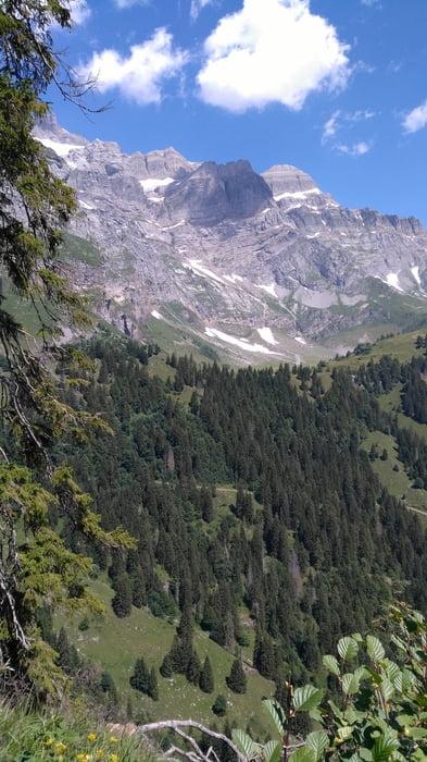
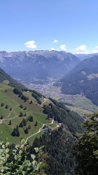
Hoch fährt man auf der Forststrasse über Schwändi an der Bächialp vorbei. Alternativ kann mit der Seilbahn Luchsigen Brunnenberg, oder mit der Standseilbahn nach Braunwald ein Teil der HM eingesparrt werden. Unterwegs hat es noch ein Picknickplatz mit schöner Aussicht, kurz danach biegt man in den Wanderweg richtung Luchsigen ab. Er ist ziemlich fordernd, hat einige Spitzkehren und 2-3 sehr kurze steile Passagen. Es war relativ Nass so habe ich gute 30 Min gebraucht.

Galeria trasy

Mapa trasy i profil wysokości

  • Open Street Map
  • Google
Minimum height 431 m Maximum height 1452 m Widok szczegółowy

More about the tour author

luckymaaa
Member since 2009

Send private message

Komentarze

von jedem Bahnhof im Glarnerland

GPS tracks

Trackpoints
  • GPX / Garmin Map Source (gpx) download
  • TCX / Garmin Training Center® (tcx) download
  • CRS / Garmin Training Center® (crs) download
  • Google Earth (kml) download
  • G7ToWin (g7t) download
  • TTQV (trk) download
  • Overlay (ovl) download
  • Fugawi (txt) download
  • Kompass (DAV) Track (tk) download
  • Karta trasy (pdf) download
  • Original file of the author (gpx) download

More about the tour author

luckymaaa
Member since 2009

Send private message
Share track
Add to my favorites
Remove from my favorites
Edit tags
My score
Rate
Trasa: KtGL, Singletrail, Braunwald Luchsigen (inkl. Trailvideo)
Rodzaj: Rower górski (MTB)
Długość: 49,8 km
Evaluated on:
Czas trwania:
Day(s)
Hour(s)
Minute(s)
Ocena: Krajobraz Czynnik zadowolenia Kondycja Technika