Login

Zapomniałeś swój login?

Cookies have to be accepted!
Your browser's cookie functionality is disabled. Please enable this functionality.

Not a member yet?

Register now
Login

Available for registred users only

Log in to use this feature.

Zapomniałeś swój login?

Cookies have to be accepted!
Your browser's cookie functionality is disabled. Please enable this functionality.

Not a member yet?

Register now
Filter
Kategorie
Advanced filters
  • Długość (km)
  • Wysokość
Zapisz filtr Reset filter

TrackRank

QRCode

Technical data

Długość32,0 km Wysokość1689 m Way down1699 m Czas trwania07:00 h:m Data18.08.2019
Oceny Author Krajobraz Czynnik zadowolenia Kondycja Technika

Statystyka

367 Widoki Oceny 27 Downloads / Pliki do pobrania Przeciętnie
Rate
  • Karta trasy
  • Dojazd
  • Downloads / Pliki do pobrania

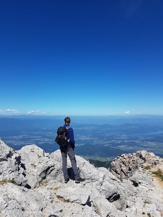
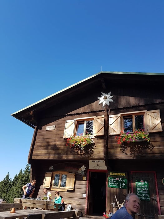
Schwere anstrengende Wanderung. Mit dem Fahrrad ging es zunächst von Faak zum Berggasthof Baumgartner. Dies sind etwa 400 HM u. knapp 7 Kilometer. Man kommt schon da ordentlich ins Schwitzen, sofern man kein E-Bike hat

Further information at

https://www.bertahuette-mittagskogel.at/index.html

Galeria trasy

Mapa trasy i profil wysokości

  • Open Street Map
  • Google
Minimum height 616 m Maximum height 2208 m Widok szczegółowy

More about the tour author

mmehle
Member since 2008

Send private message

Komentarze

Von Faak aus mit dem Fahrrad zum Berggasthof Baumgartner. Hierhin kann man auch mit dem Auto fahren.

GPS tracks

Trackpoints
  • GPX / Garmin Map Source (gpx) download
  • TCX / Garmin Training Center® (tcx) download
  • CRS / Garmin Training Center® (crs) download
  • Google Earth (kml) download
  • G7ToWin (g7t) download
  • TTQV (trk) download
  • Overlay (ovl) download
  • Fugawi (txt) download
  • Kompass (DAV) Track (tk) download
  • Karta trasy (pdf) download
  • Original file of the author (gpx) download

More about the tour author

mmehle
Member since 2008

Send private message
Share track
Add to my favorites
Remove from my favorites
Edit tags
My score
Rate
Trasa: Auf den Mittagskogel
Rodzaj: Trasy górskie
Długość: 32,0 km
Evaluated on:
Czas trwania:
Day(s)
Hour(s)
Minute(s)
Ocena: Krajobraz Czynnik zadowolenia Kondycja Technika