
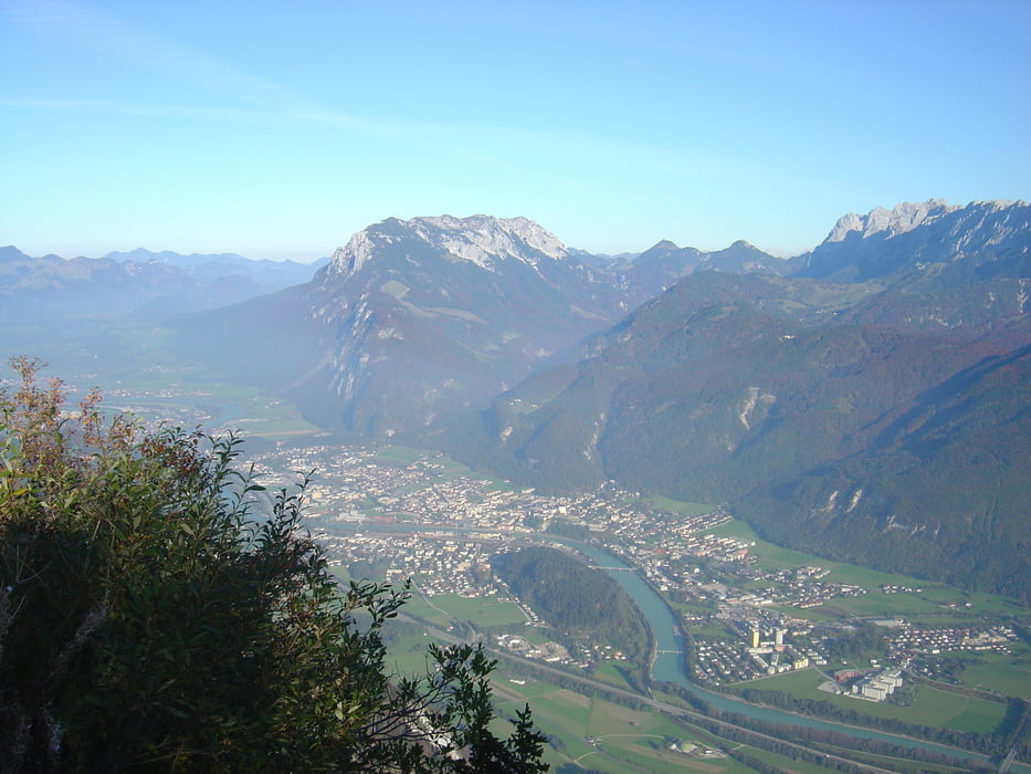

Einfach zu fahrende MTB Tour, die nur nach dem Thiersee einige steilere Passagen hat. Die Strecke führt größtenteils über Forststraße.Sehr lohnenswert wegen der fantastischen Aussicht vom Kufsteiner Haus mit dem Blick über das Inntal.
Vorsicht beim Downhill, viele Wanderer unterwegs.
Infos zum Pendling
http://de.wikipedia.org/wiki/Pendling
Infos zur Kufsteiner Haus
http://www.thierseetal.com/schneeberg/kufsteiner-haus/index.html
Mapa trasy i profil wysokości
Minimum height 523 m
Maximum height 1564 m
More about the tour author

|
der_laeufer |
Komentarze

Inntalautobahn bis Ausfahrt Kiefersfelden. In Kiefersfelden vor der Brücke dem Wegweiser nach Breitenau folgen. Nach Verlassen von Kiefersfelden nach ca. 1 km auf dem Parkplatz links parken, oder, wenn man sich die Teerstraße sparen will weiterfahren bis zu dem kleinen Industriegebiet.
GPS tracks
Trackpoints-
GPX / Garmin Map Source (gpx) download
-
TCX / Garmin Training Center® (tcx) download
-
CRS / Garmin Training Center® (crs) download
-
Google Earth (kml) download
-
G7ToWin (g7t) download
-
TTQV (trk) download
-
Overlay (ovl) download
-
Fugawi (txt) download
-
Kompass (DAV) Track (tk) download
-
Karta trasy (pdf) download
-
Original file of the author (gpx) download
More about the tour author
|
|
der_laeufer |
Add to my favorites
Remove from my favorites
Edit tags
Open track
My score
Rate