Login

Zapomniałeś swój login?

Cookies have to be accepted!
Your browser's cookie functionality is disabled. Please enable this functionality.

Not a member yet?

Register now
Login

Available for registred users only

Log in to use this feature.

Zapomniałeś swój login?

Cookies have to be accepted!
Your browser's cookie functionality is disabled. Please enable this functionality.

Not a member yet?

Register now
Filter
Kategorie
Advanced filters
  • Długość (km)
  • Wysokość
Zapisz filtr Reset filter

TrackRank

QRCode

Technical data

Długość14,3 km Wysokość357 m Way down346 m Czas trwania02:40 h:m Data04.03.2020
Oceny Author Krajobraz Czynnik zadowolenia Kondycja Technika

Statystyka

418 Widoki Oceny 93 Downloads / Pliki do pobrania Przeciętnie
Rate
  • Karta trasy
  • Dojazd
  • Downloads / Pliki do pobrania
  • Rundkurs im Uhrzeigersinn
  • Start/Ziel: Finale Ligure
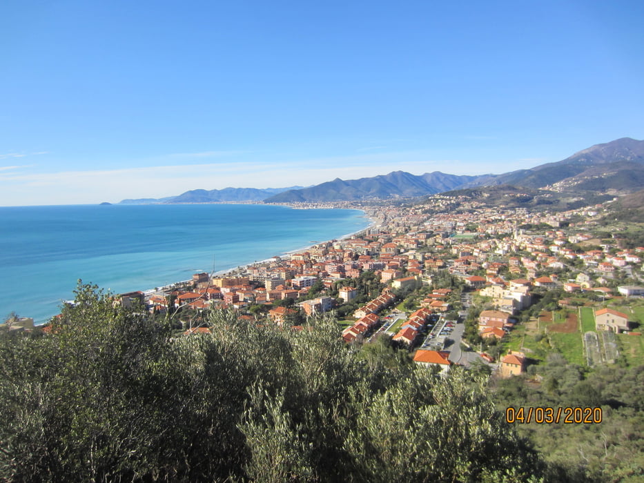
  • Einrollen auf der Staatsstrasse nach Borgio Verezzi
  • Aufstieg auf Asfalt (mittelsteil, einige kurze Rampen).
  • Höchster Punkt: Kapelle "San Martino" + Osteria (KM 9,8 - MH 267)
  • Abfahrt nach Finalborgo auf flowigem, teils etwas verblocktem Trail(S1/S2). Das letzte Teilstück auf Schotterweg mit teils steinigem Untergrund.

Galeria trasy

Mapa trasy i profil wysokości

  • Open Street Map
  • Google
Minimum height -9 m Maximum height 324 m Widok szczegółowy

More about the tour author

MargesinFriedrich
Member since 2012

Send private message

Komentarze

GPS tracks

Trackpoints
  • GPX / Garmin Map Source (gpx) download
  • TCX / Garmin Training Center® (tcx) download
  • CRS / Garmin Training Center® (crs) download
  • Google Earth (kml) download
  • G7ToWin (g7t) download
  • TTQV (trk) download
  • Overlay (ovl) download
  • Fugawi (txt) download
  • Kompass (DAV) Track (tk) download
  • Karta trasy (pdf) download
  • Original file of the author (gpx) download

More about the tour author

MargesinFriedrich
Member since 2012

Send private message
Share track
Add to my favorites
Remove from my favorites
Edit tags
My score
Rate
Trasa: Monte Caprazoppa(Finale Ligure)
Rodzaj: Rower górski (MTB)
Długość: 14,3 km
Evaluated on:
Czas trwania:
Day(s)
Hour(s)
Minute(s)
Ocena: Krajobraz Czynnik zadowolenia Kondycja Technika