Login

Zapomniałeś swój login?

Cookies have to be accepted!
Your browser's cookie functionality is disabled. Please enable this functionality.

Not a member yet?

Register now
Login

Available for registred users only

Log in to use this feature.

Zapomniałeś swój login?

Cookies have to be accepted!
Your browser's cookie functionality is disabled. Please enable this functionality.

Not a member yet?

Register now
Filter
Kategorie
Advanced filters
  • Długość (km)
  • Wysokość
Zapisz filtr Reset filter

TrackRank

QRCode

Technical data

Długość18,6 km Wysokość666 m Way down523 m Czas trwania05:30 h:m Data04.04.2020
Oceny Author Krajobraz Czynnik zadowolenia Kondycja Technika

Statystyka

180 Widoki Oceny 7 Downloads / Pliki do pobrania Przeciętnie
Rate
  • Karta trasy
  • Dojazd
  • Downloads / Pliki do pobrania
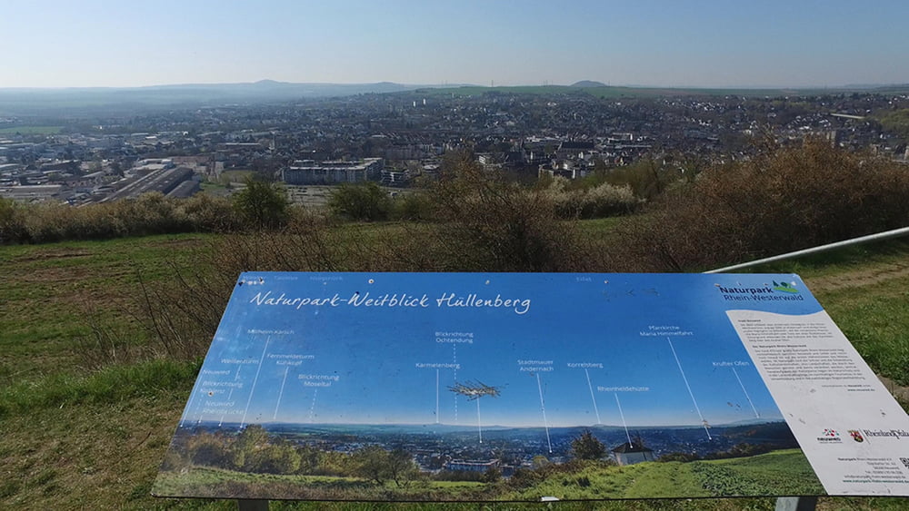
Umwege können auch ihren Reiz haben. Wir umgehen auf dieser Tour das Mittelzentrum Neuwied, das sich sehr gut zum Shoppen eignet, und gehen im weitem Bogen durch die Region zwischen romantischem Mittelrheintal und den bewaldeten Höhenrücken des Westerwaldes nach Rengsdorf. Obwohl wir uns weit vom Rhein entfernen, behalten wir sein Tal von mehreren Aussichtspunkten im Blick. Das Neuwieder Becken zu Füßen, genießen wir unterwegs die Ruhe, und folgen den Spuren der Römer.

Galeria trasy

Mapa trasy i profil wysokości

  • Open Street Map
  • Google
Minimum height 72 m Maximum height 315 m Widok szczegółowy

More about the tour author

schleidy
Member since 2013

Send private message

Komentarze

GPS tracks

Trackpoints
  • GPX / Garmin Map Source (gpx) download
  • TCX / Garmin Training Center® (tcx) download
  • CRS / Garmin Training Center® (crs) download
  • Google Earth (kml) download
  • G7ToWin (g7t) download
  • TTQV (trk) download
  • Overlay (ovl) download
  • Fugawi (txt) download
  • Kompass (DAV) Track (tk) download
  • Karta trasy (pdf) download
  • Original file of the author (gpx) download

More about the tour author

schleidy
Member since 2013

Send private message
Share track
Add to my favorites
Remove from my favorites
Edit tags
My score
Rate
Trasa: 6. Etappe Rheinsteig, Leutesdorf - Rengsdorf
Rodzaj: Wędrówki
Długość: 18,6 km
Evaluated on:
Czas trwania:
Day(s)
Hour(s)
Minute(s)
Ocena: Krajobraz Czynnik zadowolenia Kondycja Technika