Login

Zapomniałeś swój login?

Cookies have to be accepted!
Your browser's cookie functionality is disabled. Please enable this functionality.

Not a member yet?

Register now
Login

Available for registred users only

Log in to use this feature.

Zapomniałeś swój login?

Cookies have to be accepted!
Your browser's cookie functionality is disabled. Please enable this functionality.

Not a member yet?

Register now
Filter
Kategorie
Advanced filters
  • Długość (km)
  • Wysokość
Zapisz filtr Reset filter

TrackRank

QRCode

Technical data

Długość28,1 km Wysokość909 m Way down910 m Czas trwania00:00 h:m Data24.05.2020
Oceny Author Krajobraz Czynnik zadowolenia Kondycja Technika

Statystyka

143 Widoki Oceny 28 Downloads / Pliki do pobrania Przeciętnie
Rate
  • Karta trasy
  • Dojazd
  • Downloads / Pliki do pobrania
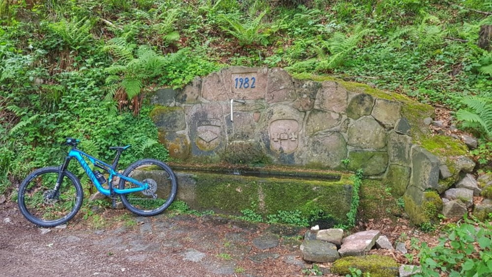
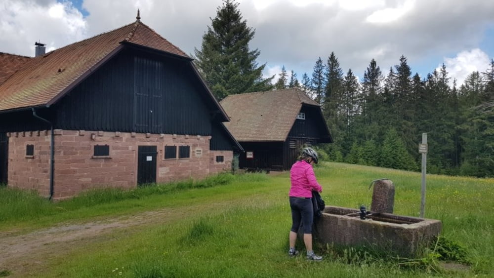
Heute Nacht haben wir oberhalb von Forbach gestanden. Am Mittag dann die Tour "Über die Alte Weinstrasse" unter die Stollen genommen. Die Tour war ein Vorschlag der Mountainbike-Arena Murgtal-Enztal. Diese ging hoch zum Hohlohturm mit einer phantastischen Aussicht als Belohnung. Unterwegs immer wieder Brunnen zum Auffüllen der Wasservorräte. Nach der Abfahrt noch eine Runde in Gausbach, der vielen Brunnen wegen. #noebike

Galeria trasy

Mapa trasy i profil wysokości

  • Open Street Map
  • Google
Minimum height 294 m Maximum height 984 m Widok szczegółowy

More about the tour author

mh021255
Member since 2009

Send private message

Komentarze

GPS tracks

Trackpoints
  • GPX / Garmin Map Source (gpx) download
  • TCX / Garmin Training Center® (tcx) download
  • CRS / Garmin Training Center® (crs) download
  • Google Earth (kml) download
  • G7ToWin (g7t) download
  • TTQV (trk) download
  • Overlay (ovl) download
  • Fugawi (txt) download
  • Kompass (DAV) Track (tk) download
  • Karta trasy (pdf) download
  • Original file of the author (gpx) download

More about the tour author

mh021255
Member since 2009

Send private message
Share track
Add to my favorites
Remove from my favorites
Edit tags
My score
Rate
Trasa: Zum Hohlohturm auf 990m
Rodzaj: Rower górski (MTB)
Długość: 28,1 km
Evaluated on:
Czas trwania:
Day(s)
Hour(s)
Minute(s)
Ocena: Krajobraz Czynnik zadowolenia Kondycja Technika