Login

Zapomniałeś swój login?

Cookies have to be accepted!
Your browser's cookie functionality is disabled. Please enable this functionality.

Not a member yet?

Register now
Login

Available for registred users only

Log in to use this feature.

Zapomniałeś swój login?

Cookies have to be accepted!
Your browser's cookie functionality is disabled. Please enable this functionality.

Not a member yet?

Register now
Filter
Kategorie
Advanced filters
  • Długość (km)
  • Wysokość
Zapisz filtr Reset filter

TrackRank

QRCode

Technical data

Długość35,8 km Wysokość472 m Way down495 m Czas trwania02:03 h:m Data22.06.2008
Oceny Author User Krajobraz Czynnik zadowolenia Kondycja Technika

Statystyka

3577 Widoki 3 Oceny 281 Downloads / Pliki do pobrania 4.33 Przeciętnie
Rate
  • Karta trasy
  • Dojazd
  • Downloads / Pliki do pobrania


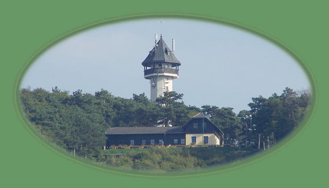
Markierte und daher für Radfahrerinnen und Radfahrer geöffnete Wienerwaldstrecke. Besonders radlerfreundlicher  Streckenverlauf, weil am Beginn wenig Steigung und daher ideal zum Aufwärmen. Erst ab Sankt Veit an der Triesting kommt der Anstieg auf den Guglzipf (473 m). Mir gefällt dabei besonders der letzte Teil, der im  Wald auf engen aber gut zu befahrenden Wegerln verläuft.


Nach einer kleinen Pause bei der Aussichtswarte, gibt es im mittleren Teil der Abfahrt wieder ein kurzes, aber sehr lustig zu fahrendes  Waldwegerlstück. Danach "landet" man direkt in einem meiner Lieblingsflecken: Kleinfeld!

Further information at

http://www.mbike.at/mbike/ww/

Galeria trasy

Mapa trasy i profil wysokości

  • Open Street Map
  • Google
Minimum height 269 m Maximum height 478 m Widok szczegółowy

More about the tour author

harnoncourt

Komentarze

misto62 on 16.09.2012

Strecke tw. abgefahren

Wollte diese Strecke mal versuchen, nur OHNE Navi geht es nicht!!! Nirgend irgend etwas beschrieben! Fast nur Asphalt und ein paar Forstwegerln. Trails gibt es überhaupt nicht!

Für MTB nicht wirklich lustig!!!


Aus Wien bequem mit der Bahn nach Leobersdorf. Preis am 21.6.2008: EUR 3,40, 1 Strecke, mit VT-Card. Nicht vergessen -> Fahrradtageskarte: EUR 2,90 (gilt - wie der Name schon sagt - den ganzen Tag).

GPS tracks

Trackpoints
  • GPX / Garmin Map Source (gpx) download
  • TCX / Garmin Training Center® (tcx) download
  • CRS / Garmin Training Center® (crs) download
  • Google Earth (kml) download
  • G7ToWin (g7t) download
  • TTQV (trk) download
  • Overlay (ovl) download
  • Fugawi (txt) download
  • Kompass (DAV) Track (tk) download
  • Karta trasy (pdf) download
  • Original file of the author (gpx) download

More about the tour author

harnoncourt

Share track
Add to my favorites
Remove from my favorites
Edit tags
My score
Rate
Trasa: Guglzipf Strecke
Rodzaj: Rower górski (MTB)
Długość: 35,8 km
Evaluated on:
Czas trwania:
Day(s)
Hour(s)
Minute(s)
Ocena: Krajobraz Czynnik zadowolenia Kondycja Technika