Login

Zapomniałeś swój login?

Cookies have to be accepted!
Your browser's cookie functionality is disabled. Please enable this functionality.

Not a member yet?

Register now
Login

Available for registred users only

Log in to use this feature.

Zapomniałeś swój login?

Cookies have to be accepted!
Your browser's cookie functionality is disabled. Please enable this functionality.

Not a member yet?

Register now
Filter
Kategorie
Advanced filters
  • Długość (km)
  • Wysokość
Zapisz filtr Reset filter

TrackRank

QRCode

Technical data

Długość15,7 km Wysokość631 m Way down612 m Czas trwania04:30 h:m Data13.10.2020
Oceny Author Krajobraz Czynnik zadowolenia Kondycja Technika

Statystyka

122 Widoki Oceny 10 Downloads / Pliki do pobrania Przeciętnie
Rate
  • Karta trasy
  • Dojazd
  • Downloads / Pliki do pobrania
Einfache Wanderung über zwei Gipfel durch eine grüne Landschaft (Oktober) mit Weitblick ans Meer.

Galeria trasy

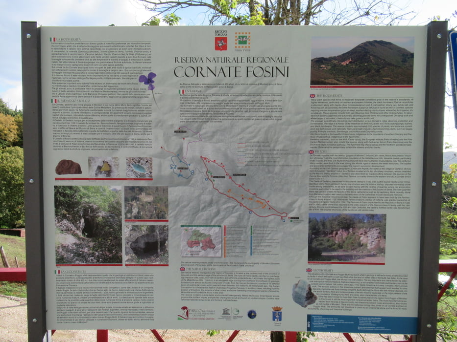
Mapa trasy i profil wysokości

  • Open Street Map
  • Google
Minimum height 677 m Maximum height 1055 m Widok szczegółowy

More about the tour author

tazzo
Member since 2009

Send private message

Komentarze

Parken kann am Ortseingang.

GPS tracks

Trackpoints
  • GPX / Garmin Map Source (gpx) download
  • TCX / Garmin Training Center® (tcx) download
  • CRS / Garmin Training Center® (crs) download
  • Google Earth (kml) download
  • G7ToWin (g7t) download
  • TTQV (trk) download
  • Overlay (ovl) download
  • Fugawi (txt) download
  • Kompass (DAV) Track (tk) download
  • Karta trasy (pdf) download
  • Original file of the author (gpx) download

More about the tour author

tazzo
Member since 2009

Send private message
Share track
Add to my favorites
Remove from my favorites
Edit tags
My score
Rate
Trasa: Hoch über Gerfalco über zwei Gipfel
Rodzaj: Wędrówki
Długość: 15,7 km
Evaluated on:
Czas trwania:
Day(s)
Hour(s)
Minute(s)
Ocena: Krajobraz Czynnik zadowolenia Kondycja Technika