Login

Zapomniałeś swój login?

Cookies have to be accepted!
Your browser's cookie functionality is disabled. Please enable this functionality.

Not a member yet?

Register now
Login

Available for registred users only

Log in to use this feature.

Zapomniałeś swój login?

Cookies have to be accepted!
Your browser's cookie functionality is disabled. Please enable this functionality.

Not a member yet?

Register now
Filter
Kategorie
Advanced filters
  • Długość (km)
  • Wysokość
Zapisz filtr Reset filter

TrackRank

QRCode

Technical data

Długość11,4 km Wysokość702 m Way down699 m Czas trwania00:00 h:m Data09.02.2021
Oceny Author Krajobraz Czynnik zadowolenia Kondycja Technika

Statystyka

173 Widoki Oceny 11 Downloads / Pliki do pobrania Przeciętnie
Rate
  • Karta trasy
  • Dojazd
  • Downloads / Pliki do pobrania
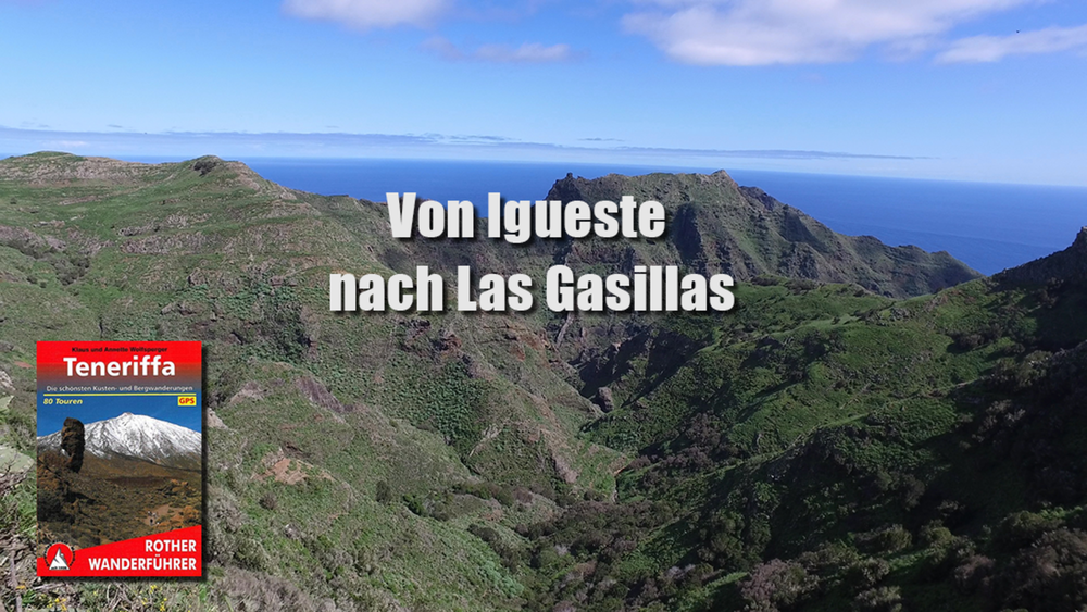
Die heutige Wanderung ist eine One way Tour das heißt das wir denselben Weg wieder zurückgehen. Die ersten 2 km verlaufen über eine Asphaltstraße von der wir dann in einen schalen und steilen Serpentinenpfad abbiegen. An dem verlassenen Weiler Las Casillas vorbei geht es weiter bergan bis zur Gebirgsstraße TF 123.  Dann auf gleichem Weg zurück zum Ausgangspunkt.

Galeria trasy

Mapa trasy i profil wysokości

  • Open Street Map
  • Google
Minimum height 32 m Maximum height 634 m Widok szczegółowy

More about the tour author

schleidy
Member since 2013

Send private message

Komentarze

GPS tracks

Trackpoints
  • GPX / Garmin Map Source (gpx) download
  • TCX / Garmin Training Center® (tcx) download
  • CRS / Garmin Training Center® (crs) download
  • Google Earth (kml) download
  • G7ToWin (g7t) download
  • TTQV (trk) download
  • Overlay (ovl) download
  • Fugawi (txt) download
  • Kompass (DAV) Track (tk) download
  • Karta trasy (pdf) download
  • Original file of the author (gpx) download

More about the tour author

schleidy
Member since 2013

Send private message
Share track
Add to my favorites
Remove from my favorites
Edit tags
My score
Rate
Trasa: Von Igueste nach Las Casillas
Rodzaj: Wędrówki
Długość: 11,4 km
Evaluated on:
Czas trwania:
Day(s)
Hour(s)
Minute(s)
Ocena: Krajobraz Czynnik zadowolenia Kondycja Technika