Login

Zapomniałeś swój login?

Cookies have to be accepted!
Your browser's cookie functionality is disabled. Please enable this functionality.

Not a member yet?

Register now
Login

Available for registred users only

Log in to use this feature.

Zapomniałeś swój login?

Cookies have to be accepted!
Your browser's cookie functionality is disabled. Please enable this functionality.

Not a member yet?

Register now
Filter
Kategorie
Advanced filters
  • Długość (km)
  • Wysokość
Zapisz filtr Reset filter

TrackRank

QRCode

Technical data

Długość13,7 km Wysokość262 m Way down214 m Czas trwania04:00 h:m Data22.05.2021
Oceny Author Krajobraz Czynnik zadowolenia Kondycja Technika

Statystyka

103 Widoki Oceny 1 Download Przeciętnie
Rate
  • Karta trasy
  • Dojazd
  • Downloads / Pliki do pobrania
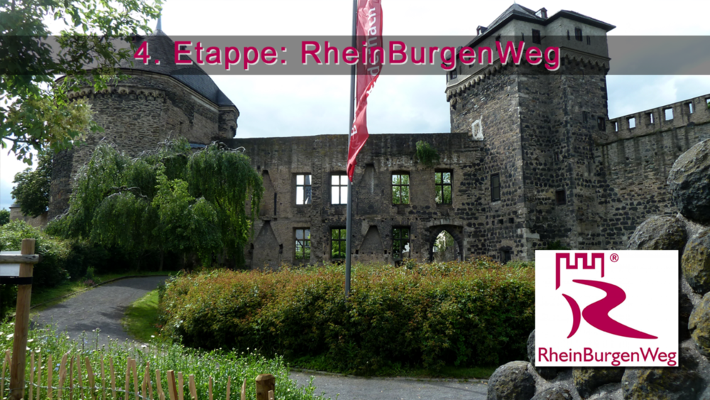
Die 4. Etappe des RBW entführt uns in eine ehemalige Welt aus Feuer und Asche! Denn auf dem Weg von Andernach nach Bassenheim passiert der RBW ausgedehnte Bimsterrassen. Außerdem bereichern das wildromantische Nettetal und sagenhafte Fernblicke die Tour. In der zweiten Hälfte der Route verläuft die Wanderung durch Ostplantagen bevor wir das Ziel Bassenheim erreichen.

Galeria trasy

Mapa trasy i profil wysokości

  • Open Street Map
  • Google
Minimum height 71 m Maximum height 217 m Widok szczegółowy

More about the tour author

schleidy
Member since 2013

Send private message

Komentarze

GPS tracks

Trackpoints
  • GPX / Garmin Map Source (gpx) download
  • TCX / Garmin Training Center® (tcx) download
  • CRS / Garmin Training Center® (crs) download
  • Google Earth (kml) download
  • G7ToWin (g7t) download
  • TTQV (trk) download
  • Overlay (ovl) download
  • Fugawi (txt) download
  • Kompass (DAV) Track (tk) download
  • Karta trasy (pdf) download
  • Original file of the author (gpx) download

More about the tour author

schleidy
Member since 2013

Send private message
Share track
Add to my favorites
Remove from my favorites
Edit tags
My score
Rate
Trasa: 4. Etappe RBW: Andernach - Bassenheim
Rodzaj: Wędrówki
Długość: 13,7 km
Evaluated on:
Czas trwania:
Day(s)
Hour(s)
Minute(s)
Ocena: Krajobraz Czynnik zadowolenia Kondycja Technika