


Diese Wanderung gehört zu den Top Wanderungen vom Ferienland-Donau-Ries.
https://www.ferienland-donau-ries.de/wege/fuerstenweg-2232/
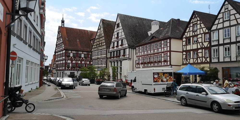
Es ist eine landschaftlich schöne hügelige Landschaft. Eine lange Strecke und man könnte sie auch gut mit einem MTB fahren. Dann benötigt man dafür keine 5 ½ Stunden und man hat mehr Zeit zum Besuch der Stadt. Öttingen ist eine romantische Stadt mit historischen Kern. Bemerkenswert sind die Häuser am Marktplatz. Auf der Ostseite sind barocke Giebel, auf der Westseite Fachwerkgiebel zu sehen. Das ist ein sehr ungewöhnlicher Anblick und kommt daher das die Stadt konfessionell Zweigeteilt war. In den Fachwerkhäusern, da wohnten früher Katholiken; und auf der anderen Seite, hinter Barockfassaden, war Wohngebiet der Protestanten.
Galeria trasy


Mapa trasy i profil wysokości
Minimum height 399 m
Maximum height 514 m
More about the tour author
|
|
JoachimDief |
Komentarze

Nach Oettingen zum Krankenhaus fahren. Die Wanderung startet direkt am Krankenausparkplatz an der Info Tafel.
GPS tracks
Trackpoints-
GPX / Garmin Map Source (gpx) download
-
TCX / Garmin Training Center® (tcx) download
-
CRS / Garmin Training Center® (crs) download
-
Google Earth (kml) download
-
G7ToWin (g7t) download
-
TTQV (trk) download
-
Overlay (ovl) download
-
Fugawi (txt) download
-
Kompass (DAV) Track (tk) download
-
Karta trasy (pdf) download
-
Original file of the author (gpx) download
More about the tour author
|
|
JoachimDief |
Add to my favorites
Remove from my favorites
Edit tags
Open track
My score
Rate