Login

Zapomniałeś swój login?

Cookies have to be accepted!
Your browser's cookie functionality is disabled. Please enable this functionality.

Not a member yet?

Register now
Login

Available for registred users only

Log in to use this feature.

Zapomniałeś swój login?

Cookies have to be accepted!
Your browser's cookie functionality is disabled. Please enable this functionality.

Not a member yet?

Register now
Filter
Kategorie
Advanced filters
  • Długość (km)
  • Wysokość
Zapisz filtr Reset filter

TrackRank

QRCode

Technical data

Długość9,8 km Wysokość483 m Way down487 m Czas trwania00:00 h:m Data20.01.2022
Oceny Author Krajobraz Czynnik zadowolenia Kondycja Technika

Statystyka

139 Widoki Oceny 6 Downloads / Pliki do pobrania Przeciętnie
Rate
  • Karta trasy
  • Dojazd
  • Downloads / Pliki do pobrania
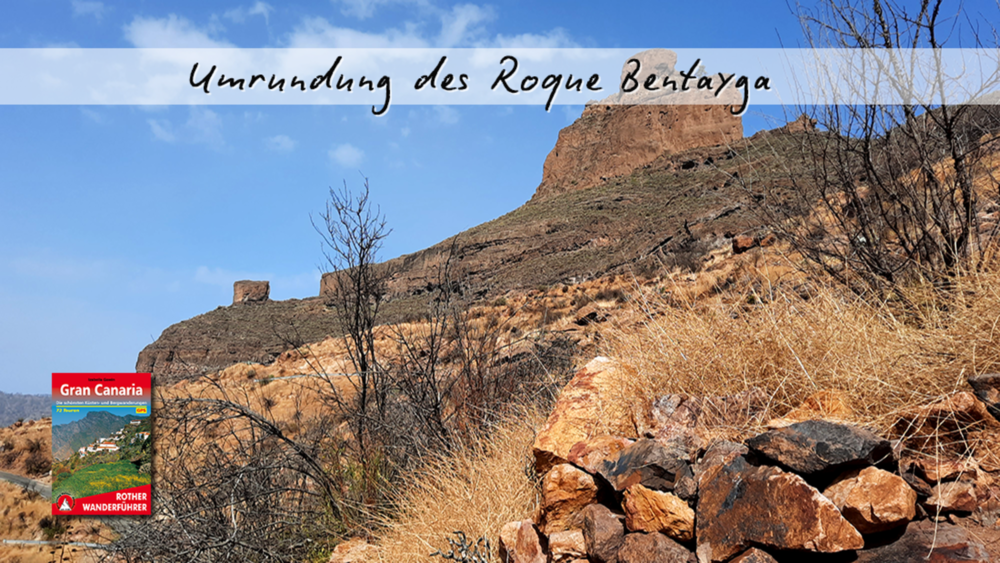
Am Fuße vom Roque Bentayga geht es in das Tal des Barranco de los Choza zum Weiler El Espinillo. Über einen Bergkamm verläuft der weitere Pfad, bis er in unendlichen Serpentinen, im Ort La Solana endet. Von hier beginnt der Rückweg, über eine selten befahrene Straße, auf die Rückseite der Kultstätte. Nach einem kurzen Abstecher in den Weiler El Roque folgen wir der Straße bis zum Ausgangspunkt.

Galeria trasy

Mapa trasy i profil wysokości

  • Open Street Map
  • Google
Minimum height 657 m Maximum height 1150 m Widok szczegółowy

More about the tour author

schleidy
Member since 2013

Send private message

Komentarze

GPS tracks

Trackpoints
  • GPX / Garmin Map Source (gpx) download
  • TCX / Garmin Training Center® (tcx) download
  • CRS / Garmin Training Center® (crs) download
  • Google Earth (kml) download
  • G7ToWin (g7t) download
  • TTQV (trk) download
  • Overlay (ovl) download
  • Fugawi (txt) download
  • Kompass (DAV) Track (tk) download
  • Karta trasy (pdf) download
  • Original file of the author (gpx) download

More about the tour author

schleidy
Member since 2013

Send private message
Share track
Add to my favorites
Remove from my favorites
Edit tags
My score
Rate
Trasa: Die Umrundung vom Roque Bentaiga
Rodzaj: Wędrówki
Długość: 9,8 km
Evaluated on:
Czas trwania:
Day(s)
Hour(s)
Minute(s)
Ocena: Krajobraz Czynnik zadowolenia Kondycja Technika