Login

Zapomniałeś swój login?

Cookies have to be accepted!
Your browser's cookie functionality is disabled. Please enable this functionality.

Not a member yet?

Register now
Login

Available for registred users only

Log in to use this feature.

Zapomniałeś swój login?

Cookies have to be accepted!
Your browser's cookie functionality is disabled. Please enable this functionality.

Not a member yet?

Register now
Filter
Kategorie
Advanced filters
  • Długość (km)
  • Wysokość
Zapisz filtr Reset filter

TrackRank

QRCode

Technical data

Długość10,7 km Wysokość742 m Way down747 m Czas trwania00:00 h:m Data16.06.2022
Oceny Author Krajobraz Czynnik zadowolenia Kondycja Technika

Statystyka

171 Widoki Oceny 3 Downloads / Pliki do pobrania Przeciętnie
Rate
  • Karta trasy
  • Dojazd
  • Downloads / Pliki do pobrania

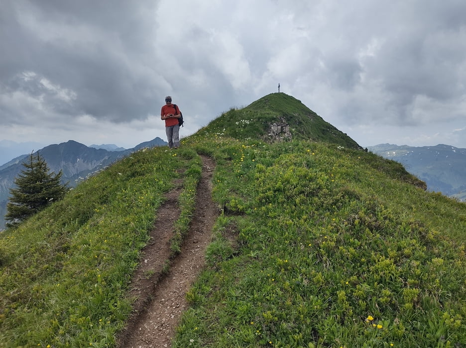
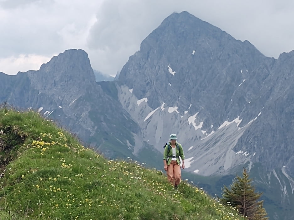
Die fuehrt durch sehr schoene und leicht alpine Landschaft.  Teilweise etwas ausgesetzt mit Stahlseilsicherung, aber im Grossen und Ganzen einfach.

Ganz am ende der Tour war der Weg vom Stutztobelbach weggespuelt. Die Querung ist schwierig. Status vom 16.06.2022. Ich empfehle furr die letzten Kilometer den G[terweg zun nehmen. Informiert mich wenn der Weg wieder passierbar ist. 

Galeria trasy

Mapa trasy i profil wysokości

  • Open Street Map
  • Google
Minimum height 1441 m Maximum height 2116 m Widok szczegółowy

More about the tour author

Christi0012
Member since 2005

Send private message

Komentarze

Parken am grossen Schotterparkplatz am Faschinajoch

GPS tracks

Trackpoints
  • GPX / Garmin Map Source (gpx) download
  • TCX / Garmin Training Center® (tcx) download
  • CRS / Garmin Training Center® (crs) download
  • Google Earth (kml) download
  • G7ToWin (g7t) download
  • TTQV (trk) download
  • Overlay (ovl) download
  • Fugawi (txt) download
  • Kompass (DAV) Track (tk) download
  • Karta trasy (pdf) download
  • Original file of the author (gpx) download

More about the tour author

Christi0012
Member since 2005

Send private message
Share track
Add to my favorites
Remove from my favorites
Edit tags
My score
Rate
Trasa: Zafernhorn Rundtour vom Furkajoch
Rodzaj: Wędrówki
Długość: 10,7 km
Evaluated on:
Czas trwania:
Day(s)
Hour(s)
Minute(s)
Ocena: Krajobraz Czynnik zadowolenia Kondycja Technika