Login

Zapomniałeś swój login?

Cookies have to be accepted!
Your browser's cookie functionality is disabled. Please enable this functionality.

Not a member yet?

Register now
Login

Available for registred users only

Log in to use this feature.

Zapomniałeś swój login?

Cookies have to be accepted!
Your browser's cookie functionality is disabled. Please enable this functionality.

Not a member yet?

Register now
Filter
Kategorie
Advanced filters
  • Długość (km)
  • Wysokość
Zapisz filtr Reset filter

TrackRank

QRCode

Technical data

Długość10,1 km Wysokość356 m Way down353 m Czas trwania03:30 h:m Data15.06.2022
Oceny Author Krajobraz Czynnik zadowolenia Kondycja Technika

Statystyka

109 Widoki Oceny 3 Downloads / Pliki do pobrania Przeciętnie
Rate
  • Karta trasy
  • Dojazd
  • Downloads / Pliki do pobrania
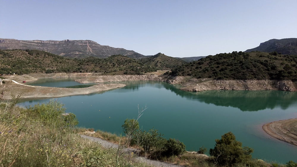
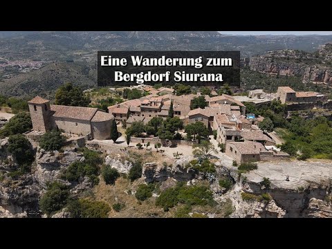
Unsere Wanderung führt uns von der Staumauer entlang des Ufers vom Siurana Stausee. Anschließend folgen wir dem gleichnamigen Bachlauf bis uns die Beschilderung steil hinauf zum Ort Siurana führt. Nach einem Rundgang in dem Geschichtsträchtige Dorf verlassen wir die Anhöhe und gehen wieder hinunter zum Stausee. Eine Asphaltstraße erreicht folgen wir dieser bis zur Staumauer, überqueren diese und gelangen somit wieder zu unserem Auto.

Galeria trasy

Mapa trasy i profil wysokości

  • Open Street Map
  • Google
Minimum height 605 m Maximum height 884 m Widok szczegółowy

More about the tour author

schleidy
Member since 2013

Send private message

Komentarze

GPS tracks

Trackpoints
  • GPX / Garmin Map Source (gpx) download
  • TCX / Garmin Training Center® (tcx) download
  • CRS / Garmin Training Center® (crs) download
  • Google Earth (kml) download
  • G7ToWin (g7t) download
  • TTQV (trk) download
  • Overlay (ovl) download
  • Fugawi (txt) download
  • Kompass (DAV) Track (tk) download
  • Karta trasy (pdf) download
  • Original file of the author (gpx) download

More about the tour author

schleidy
Member since 2013

Send private message
Share track
Add to my favorites
Remove from my favorites
Edit tags
My score
Rate
Trasa: Spanien: Zum Bergdorf Siuranan
Rodzaj: Wędrówki
Długość: 10,1 km
Evaluated on:
Czas trwania:
Day(s)
Hour(s)
Minute(s)
Ocena: Krajobraz Czynnik zadowolenia Kondycja Technika