Login

Zapomniałeś swój login?

Cookies have to be accepted!
Your browser's cookie functionality is disabled. Please enable this functionality.

Not a member yet?

Register now
Login

Available for registred users only

Log in to use this feature.

Zapomniałeś swój login?

Cookies have to be accepted!
Your browser's cookie functionality is disabled. Please enable this functionality.

Not a member yet?

Register now
Filter
Kategorie
Advanced filters
  • Długość (km)
  • Wysokość
Zapisz filtr Reset filter

TrackRank

QRCode

Technical data

Długość29,6 km Wysokość41 m Way down54 m Czas trwania03:00 h:m Data04.10.2022
Oceny Author Krajobraz Czynnik zadowolenia Kondycja Technika

Statystyka

176 Widoki Oceny 10 Downloads / Pliki do pobrania Przeciętnie
Rate
  • Karta trasy
  • Dojazd
  • Downloads / Pliki do pobrania
  • Rundkurs gegen den Uhrzeigersinn. 
  • Start/Ziel: Castiglione della Pescaia/Camping "Sans Souci".
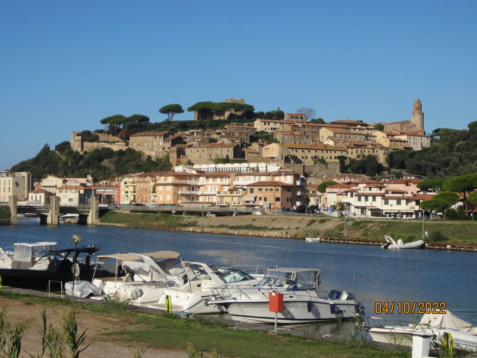
  • KM 15 zur Ruine auf der Anhöhe hochfahren. Schöner Rundblick.
  • KM 16,3 Vogelbeobachtungs-Station. Flamingos, Enten, usw. 
  • Im Oktober kein Insektenbroblem. Im Sommer Insektenspray notwendig.
  • Wenn es nicht kurz vorher geregntet hat ist die Strecke auch fürsTreckingbike geeignet.
  • Während der ganzen Tour ist man der Sonne ausgesetzt.

Galeria trasy

Mapa trasy i profil wysokości

  • Open Street Map
  • Google
Minimum height 62 m Maximum height 84 m Widok szczegółowy

More about the tour author

MargesinFriedrich
Member since 2012

Send private message

Komentarze

GPS tracks

Trackpoints
  • GPX / Garmin Map Source (gpx) download
  • TCX / Garmin Training Center® (tcx) download
  • CRS / Garmin Training Center® (crs) download
  • Google Earth (kml) download
  • G7ToWin (g7t) download
  • TTQV (trk) download
  • Overlay (ovl) download
  • Fugawi (txt) download
  • Kompass (DAV) Track (tk) download
  • Karta trasy (pdf) download
  • Original file of the author (gpx) download

More about the tour author

MargesinFriedrich
Member since 2012

Send private message
Share track
Add to my favorites
Remove from my favorites
Edit tags
My score
Rate
Trasa: Castiglione della Pescaia-Diaccia Botrona(Naturschutzgebiet).
Rodzaj: Rower górski (MTB)
Długość: 29,6 km
Evaluated on:
Czas trwania:
Day(s)
Hour(s)
Minute(s)
Ocena: Krajobraz Czynnik zadowolenia Kondycja Technika