Login

Zapomniałeś swój login?

Cookies have to be accepted!
Your browser's cookie functionality is disabled. Please enable this functionality.

Not a member yet?

Register now
Login

Available for registred users only

Log in to use this feature.

Zapomniałeś swój login?

Cookies have to be accepted!
Your browser's cookie functionality is disabled. Please enable this functionality.

Not a member yet?

Register now
Filter
Kategorie
Advanced filters
  • Długość (km)
  • Wysokość
Zapisz filtr Reset filter

TrackRank

QRCode

Technical data

Długość22,7 km Wysokość612 m Way down619 m Czas trwania00:00 h:m Data25.11.2020
Oceny Author Krajobraz Czynnik zadowolenia Kondycja Technika

Statystyka

101 Widoki Oceny 1 Download Przeciętnie
Rate
  • Karta trasy
  • Dojazd
  • Downloads / Pliki do pobrania

Vom Wanderparkplatz an der Obernautalsperre gehen wir gerade über die Schleuse und gehen direkt ansteigend den Berg hoch. Dabei kommen wir u.a. an den Höhen Windhain, Alte Burg, Breiter Berg, Ederquelle, Bocksberg und Steinwäldchen vorbei.

Weiterhin sind sehr gut auf dieser Wanderung die Keltengräber, -wälle zu sehen. Insgesamt eine Tour die gute Kondition erfordert.
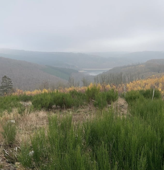
Galeria trasy

Mapa trasy i profil wysokości

  • Open Street Map
  • Google
Minimum height 326 m Maximum height 668 m Widok szczegółowy

More about the tour author

revvot
Member since 2017

Send private message

Komentarze

GPS tracks

Trackpoints
  • GPX / Garmin Map Source (gpx) download
  • TCX / Garmin Training Center® (tcx) download
  • CRS / Garmin Training Center® (crs) download
  • Google Earth (kml) download
  • G7ToWin (g7t) download
  • TTQV (trk) download
  • Overlay (ovl) download
  • Fugawi (txt) download
  • Kompass (DAV) Track (tk) download
  • Karta trasy (pdf) download
  • Original file of the author (gpx) download

More about the tour author

revvot
Member since 2017

Send private message
Share track
Add to my favorites
Remove from my favorites
Edit tags
My score
Rate
Trasa: Obernautalsperre (große Umgehung) - Ederquelle - Keltengräber
Rodzaj: Wędrówki
Długość: 22,7 km
Evaluated on:
Czas trwania:
Day(s)
Hour(s)
Minute(s)
Ocena: Krajobraz Czynnik zadowolenia Kondycja Technika