Login

Zapomniałeś swój login?

Cookies have to be accepted!
Your browser's cookie functionality is disabled. Please enable this functionality.

Not a member yet?

Register now
Login

Available for registred users only

Log in to use this feature.

Zapomniałeś swój login?

Cookies have to be accepted!
Your browser's cookie functionality is disabled. Please enable this functionality.

Not a member yet?

Register now
Filter
Kategorie
Advanced filters
  • Długość (km)
  • Wysokość
Zapisz filtr Reset filter

TrackRank

QRCode

Technical data

Długość91,0 km Wysokość1794 m Way down1790 m Czas trwania05:00 h:m Data06.11.2022
Oceny Author Krajobraz Czynnik zadowolenia Kondycja Technika

Statystyka

279 Widoki Oceny 5 Downloads / Pliki do pobrania Przeciętnie
Rate
  • Karta trasy
  • Dojazd
  • Downloads / Pliki do pobrania

Von Sanremo über die „Pista ciclabile della Riviera dei Fiori“ ins Zentrum und nun fast nur bergauf bis zum höchsten Punkt, den Monte Ceppo (1500m).

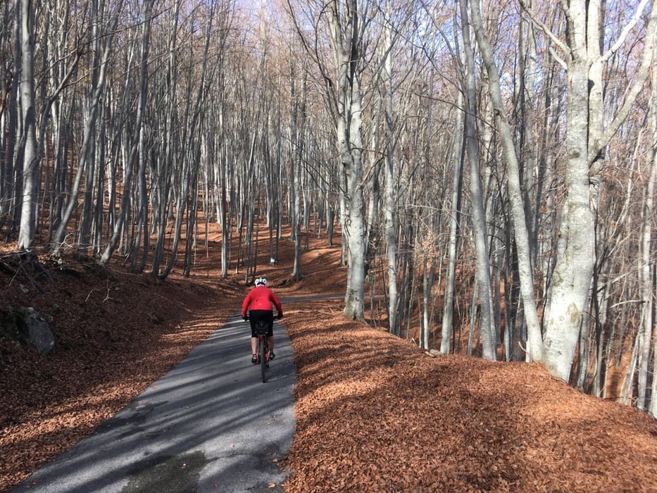
Anfangs auf guter Bergstraße hinauf nach San Romolo (Einkehrmöglichkeit). Jetzt etwas bergab, ab hier ist der Untergrund etwas schlechter, aber auch kein Verkehr, bis auf ein paar Jäger ist hier niemand mehr unterwegs, dann hinauf zum Passo Di Ghimbegna (900m). Hier nehmen wir die Strada Panoramica die teilweise flach bis zum nächsten Abzweig verläuft. Nun sind noch ca7 Km und 500 Hm bis zum höchsten Punkt der Tour.

Es folgen folgen 15 Km Abfahrt bis Molini di Triora, das erste Dorf unten im Valle Argentina. Wir folgen das Tal bis ans Meer und nehmen wieder die Ciclabile dei Fiori bis zu unseren Startpunkt.

Further information at

https://www.reise-nach-italien.de/sanremo.html

Galeria trasy

Mapa trasy i profil wysokości

  • Open Street Map
  • Google
Minimum height 14 m Maximum height 1495 m Widok szczegółowy

More about the tour author

Califan
Member since 2010

Send private message

Komentarze

https://www.google.com/maps/place/Parcheggio+%E2%82%AC/@43.8071842,7.7511724,231m/data=!3m1!1e3!4m13!1m7!3m6!1s0x12cdf5450348b727:0x3c017283ac41265d!2s18038+Sanremo,+Imperia!3b1!8m2!3d43.8159671!4d7.7760567!3m4!1s0x12cdf53fff3481d7:0x3ac1848929c1f1f6!8m2!3d43.8074914!4d7.7525942

GPS tracks

Trackpoints
  • GPX / Garmin Map Source (gpx) download
  • TCX / Garmin Training Center® (tcx) download
  • CRS / Garmin Training Center® (crs) download
  • Google Earth (kml) download
  • G7ToWin (g7t) download
  • TTQV (trk) download
  • Overlay (ovl) download
  • Fugawi (txt) download
  • Kompass (DAV) Track (tk) download
  • Karta trasy (pdf) download
  • Original file of the author (gpx) download

More about the tour author

Califan
Member since 2010

Send private message
Share track
Add to my favorites
Remove from my favorites
Edit tags
My score
Rate
Trasa: Von Sanremo auf den Monte Ceppo
Rodzaj: Rower szosowy
Długość: 91,0 km
Evaluated on:
Czas trwania:
Day(s)
Hour(s)
Minute(s)
Ocena: Krajobraz Czynnik zadowolenia Kondycja Technika