Login

Zapomniałeś swój login?

Cookies have to be accepted!
Your browser's cookie functionality is disabled. Please enable this functionality.

Not a member yet?

Register now
Login

Available for registred users only

Log in to use this feature.

Zapomniałeś swój login?

Cookies have to be accepted!
Your browser's cookie functionality is disabled. Please enable this functionality.

Not a member yet?

Register now
Filter
Kategorie
Advanced filters
  • Długość (km)
  • Wysokość
Zapisz filtr Reset filter

TrackRank

QRCode

Technical data

Długość12,2 km Wysokość773 m Way down900 m Czas trwania05:30 h:m Data12.02.2023
Oceny Author Krajobraz Czynnik zadowolenia Kondycja Technika

Statystyka

258 Widoki Oceny 6 Downloads / Pliki do pobrania Przeciętnie
Rate
  • Karta trasy
  • Dojazd
  • Downloads / Pliki do pobrania
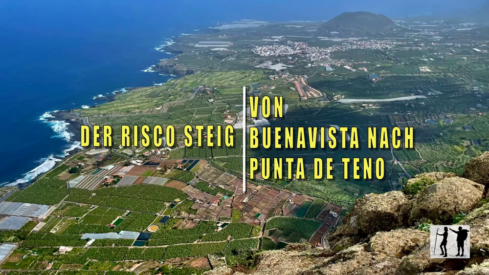
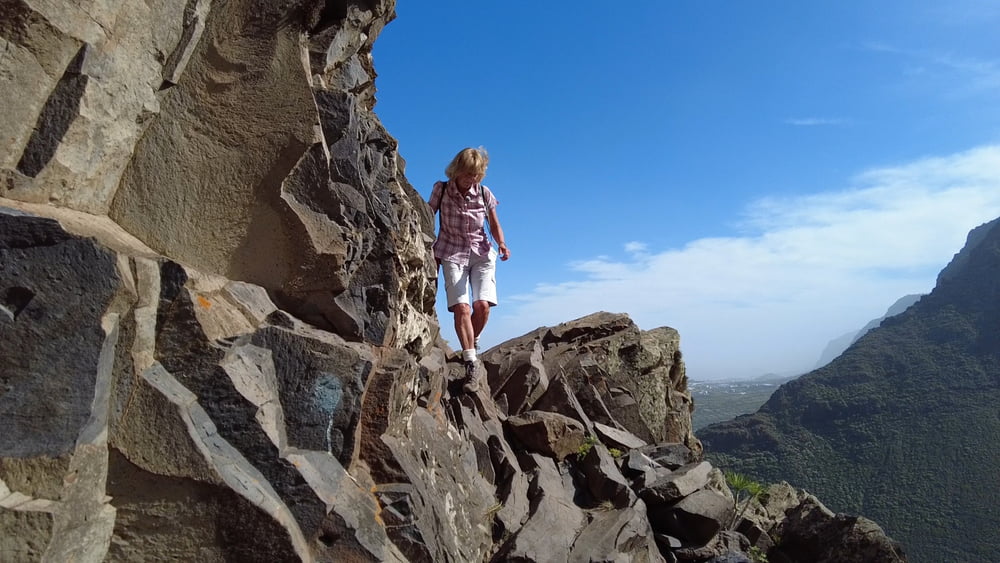
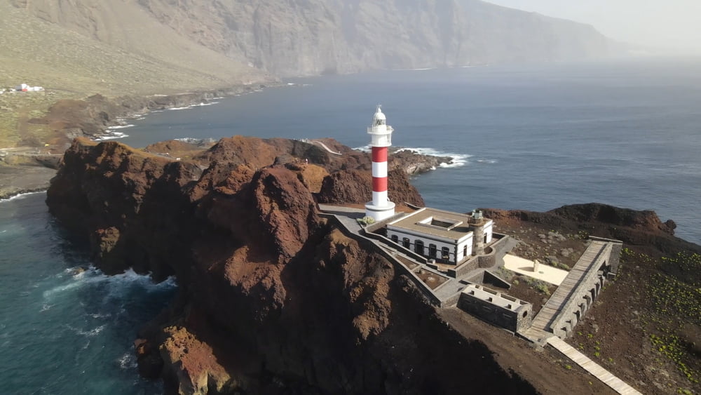
Der Risco Steig, welch treffender Name: Der Felsen-Steig führt mitten durch die steilen, teilweise senkrecht zur Ebene von Buenavista hin abbrechenden Felswände des Teno-Gebirges, ein Nervenkitzel ohnegleichen, der durch Atemberaubende Tiefblicke belohnt wird. Der Abstieg von Teno Alto nach Punta de Teno, durch einen abgeschieden, achaischer Landstrich, zum Nord-West Zipfel Teneriffas, gehört zu den beliebtesten Wanderungen im Teno Gebirge.

Galeria trasy

Mapa trasy i profil wysokości

  • Open Street Map
  • Google
Minimum height 7 m Maximum height 802 m Widok szczegółowy

More about the tour author

schleidy
Member since 2013

Send private message

Komentarze

GPS tracks

Trackpoints
  • GPX / Garmin Map Source (gpx) download
  • TCX / Garmin Training Center® (tcx) download
  • CRS / Garmin Training Center® (crs) download
  • Google Earth (kml) download
  • G7ToWin (g7t) download
  • TTQV (trk) download
  • Overlay (ovl) download
  • Fugawi (txt) download
  • Kompass (DAV) Track (tk) download
  • Karta trasy (pdf) download
  • Original file of the author (gpx) download

More about the tour author

schleidy
Member since 2013

Send private message
Share track
Add to my favorites
Remove from my favorites
Edit tags
My score
Rate
Trasa: Teneriffa: Der Riscosteig nach Punta de Teno
Rodzaj: Wędrówki
Długość: 12,2 km
Evaluated on:
Czas trwania:
Day(s)
Hour(s)
Minute(s)
Ocena: Krajobraz Czynnik zadowolenia Kondycja Technika