Login

Zapomniałeś swój login?

Cookies have to be accepted!
Your browser's cookie functionality is disabled. Please enable this functionality.

Not a member yet?

Register now
Login

Available for registred users only

Log in to use this feature.

Zapomniałeś swój login?

Cookies have to be accepted!
Your browser's cookie functionality is disabled. Please enable this functionality.

Not a member yet?

Register now
Filter
Kategorie
Advanced filters
  • Długość (km)
  • Wysokość
Zapisz filtr Reset filter

TrackRank

QRCode

Technical data

Długość23,4 km Wysokość563 m Way down576 m Czas trwania02:30 h:m Data07.10.2023
Oceny Author Krajobraz Czynnik zadowolenia Kondycja Technika

Statystyka

311 Widoki Oceny 1 Download Przeciętnie
Rate
  • Karta trasy
  • Dojazd
  • Downloads / Pliki do pobrania
  • Rundkurs gegen den Uhrzeigersinn.
  • Start/Ziel: Lago di Revine/Campingplatz.
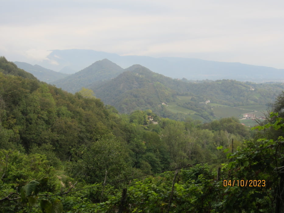
  • Abwechslungsreicher Rundkurs durch das Prosecco-Anbaugebiet.
  • Verkehrsfrei.
  • Vorwiegend asfaltierte Nebenstrassen, Wege.
  • Kurze, steile Anstiege 15%.
  • Leicht zu befahrende Abschnitte auf Schotterwegen/Waldwegen.
  • Bin die Tour mit dem E-MTB gefahren.

Galeria trasy

Mapa trasy i profil wysokości

  • Open Street Map
  • Google
Minimum height 144 m Maximum height 411 m Widok szczegółowy

More about the tour author

MargesinFriedrich
Member since 2012

Send private message

Komentarze

GPS tracks

Trackpoints
  • GPX / Garmin Map Source (gpx) download
  • TCX / Garmin Training Center® (tcx) download
  • CRS / Garmin Training Center® (crs) download
  • Google Earth (kml) download
  • G7ToWin (g7t) download
  • TTQV (trk) download
  • Overlay (ovl) download
  • Fugawi (txt) download
  • Kompass (DAV) Track (tk) download
  • Karta trasy (pdf) download
  • Original file of the author (gpx) download

More about the tour author

MargesinFriedrich
Member since 2012

Send private message
Share track
Add to my favorites
Remove from my favorites
Edit tags
My score
Rate
Trasa: Lago di Revine(Valdobbiadene)-Tarzo/Hinterland.
Rodzaj: Rower górski (MTB)
Długość: 23,4 km
Evaluated on:
Czas trwania:
Day(s)
Hour(s)
Minute(s)
Ocena: Krajobraz Czynnik zadowolenia Kondycja Technika