


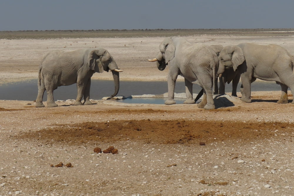
Nach einer Übernachtung im Eldorado Lodge Hotel ging es nochmals, diesmal mit unserem Bus, in den Nationalpark hinein. Am eindrucksvollsten war ein längerer Aufenthalt beim Nebrowni Waterhole, denn dort hatten wir beim zweiten Versuch das Glück, eine kleine Herde von Elefantenbullen längere Zeit zu beobachten.
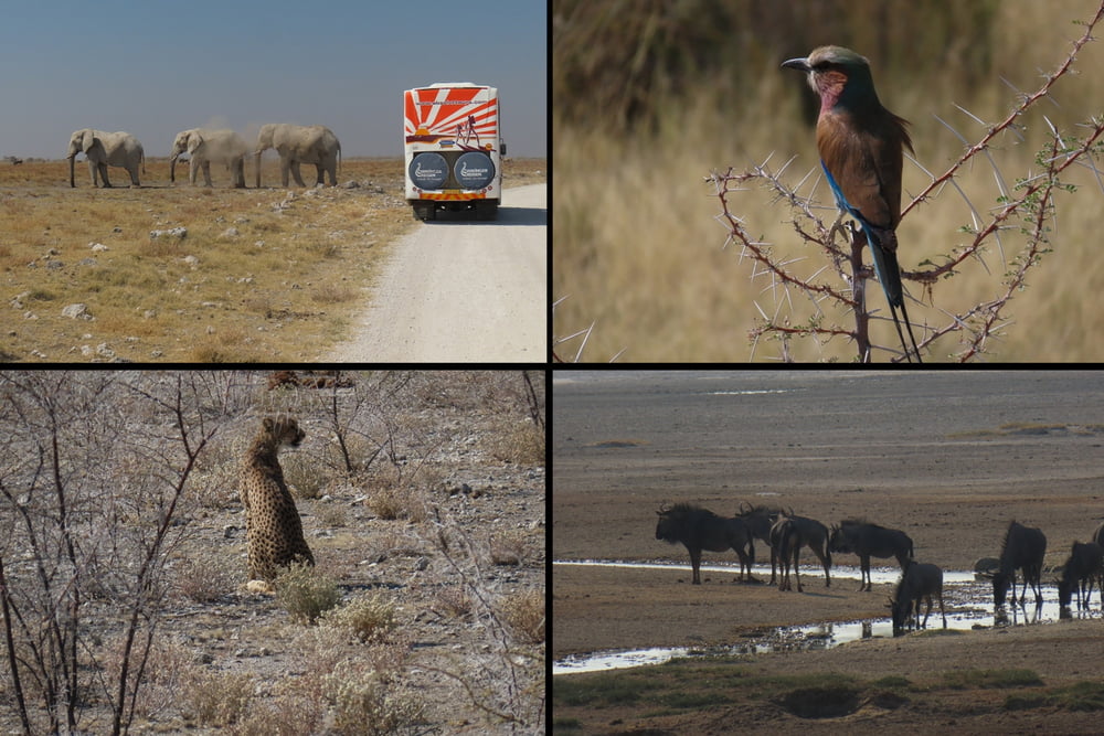
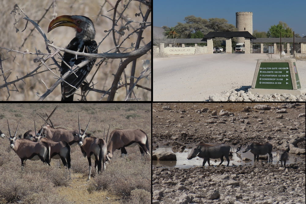
Vieles ist im Internet nachzulesen, siehe >> h i e r << Ich möchte hier nicht näher darauf eingehen, die Fotos sprechen für sich.
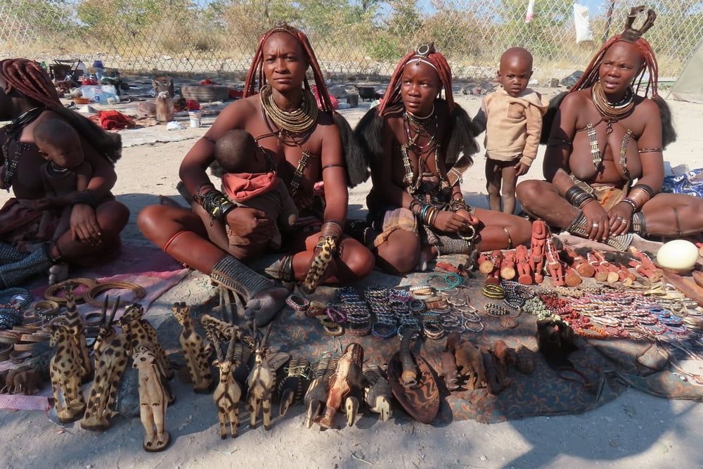
Am Ausgang des Nationalparks boten Himbafrauen Waren an. Für Fotos standen sie zur Verfügung, kauft man dort etwas ein.
Erläuterungen zur gesamten Unternehmung einschließlich der Unterkünfte siehe >> h i e r <<
Further information at
https://www.wikinger-reisen.de/Galeria trasy
Mapa trasy i profil wysokości
Minimum height 1075 m
Maximum height 1166 m
More about the tour author
|
|
herzi |
Komentarze

Flug von Frankfurt nach Windhoek 10 Stunden, gut 8000 km.
GPS tracks
Trackpoints-
GPX / Garmin Map Source (gpx) download
-
TCX / Garmin Training Center® (tcx) download
-
CRS / Garmin Training Center® (crs) download
-
Google Earth (kml) download
-
G7ToWin (g7t) download
-
TTQV (trk) download
-
Overlay (ovl) download
-
Fugawi (txt) download
-
Kompass (DAV) Track (tk) download
-
Karta trasy (pdf) download
-
Original file of the author (gpx) download
More about the tour author
|
|
herzi |
Add to my favorites
Remove from my favorites
Edit tags
Open track
My score
Rate