


Oberstdorf-Schwarze Hütte-Schrofenpass-Warth-Lech-Freiburger Hütte
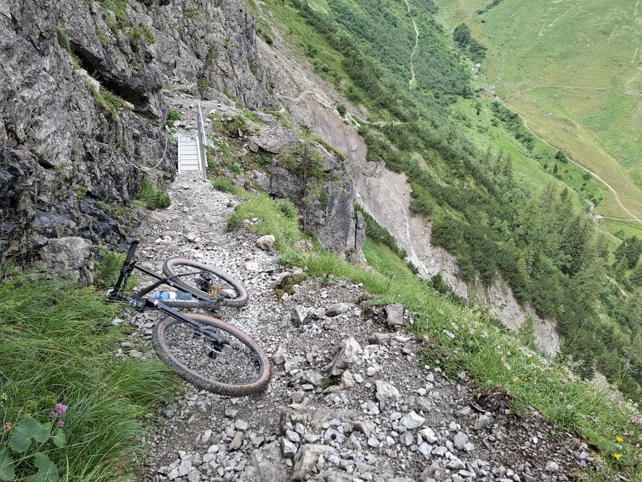
Die Anfahrt zum Schrofenpass ist sehr gemütlich, erst am Schluss wird’s steil. Und dann die Schiebestrecke rauf zum Pass ist tw ausgesetzt und zum Glück immer wieder seilgesichert - gute halbe Stunde.
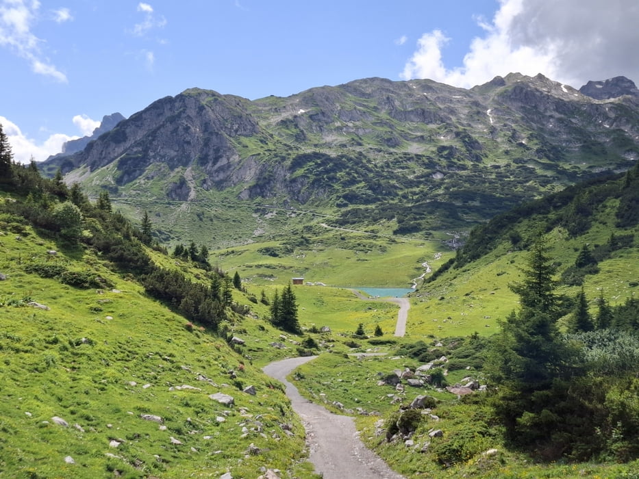
Runter schwierig zu fahrender Almtrail. Ich habe viel geschoben, noch mal ca 30'. Dann geht’s auf der Straße nach Warth, da hab ich in einem Imbissladen gut zu Mittag gegessen.
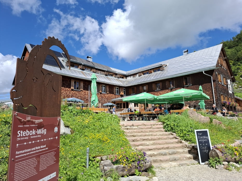
Rauf zur Freiburger Hütte ein schönes Sträßchen, Achtung Busverkehr! Der Formarinsee bei der Hütte erscheint bei Sonnenschein in seiner ganzen Pracht!
Quartier: Freiburger Hütte, Lager HP ca 66€. Ich werde kein Freund von dieser Hütte…
Galeria trasy
Mapa trasy i profil wysokości
Minimum height 800 m
Maximum height 1918 m
More about the tour author
|
|
mitter |
Komentarze

Start bei Oberstdorf, Hostel Oberstdorf.
GPS tracks
Trackpoints-
GPX / Garmin Map Source (gpx) download
-
TCX / Garmin Training Center® (tcx) download
-
CRS / Garmin Training Center® (crs) download
-
Google Earth (kml) download
-
G7ToWin (g7t) download
-
TTQV (trk) download
-
Overlay (ovl) download
-
Fugawi (txt) download
-
Kompass (DAV) Track (tk) download
-
Karta trasy (pdf) download
-
Original file of the author (gpx) download
More about the tour author
|
|
mitter |
Add to my favorites
Remove from my favorites
Edit tags
Open track
My score
Rate