Login

Zapomniałeś swój login?

Cookies have to be accepted!
Your browser's cookie functionality is disabled. Please enable this functionality.

Not a member yet?

Register now
Login

Available for registred users only

Log in to use this feature.

Zapomniałeś swój login?

Cookies have to be accepted!
Your browser's cookie functionality is disabled. Please enable this functionality.

Not a member yet?

Register now
Filter
Kategorie
Advanced filters
  • Długość (km)
  • Wysokość
Zapisz filtr Reset filter

TrackRank

QRCode

Technical data

Długość60,5 km Wysokość1424 m Way down1417 m Czas trwania04:55 h:m Data25.08.2024
Oceny Author Krajobraz Czynnik zadowolenia Kondycja Technika

Statystyka

73 Widoki Oceny 0 Downloads / Pliki do pobrania Przeciętnie
Rate
  • Karta trasy
  • Dojazd
  • Downloads / Pliki do pobrania

Pianezzo-Osteria La Peonia-Trail 300hm-San Nicolao-Mendrisio-Capolago-Rancate-Stabio-Serpiano-Monte San Giorgio-Rancate-Mendrisio-Pianezzo

Rauf zur Osteria La Peonia ca 100hm. Da steigen wir in den Trail 300hm runter ein. Leider sehr holprig, aber immerhin fahrbar. Lustig ist was anderes. Ab da nur noch Straße. 

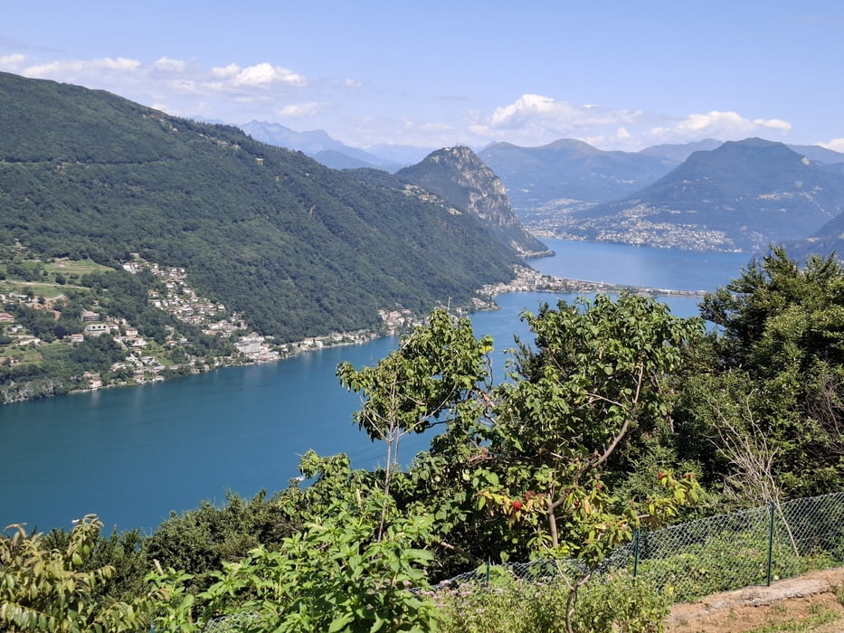
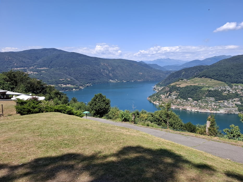
In Serpiano haben wir einen wunderbaren Ausblick auf den Luganer See. Retour über Mendrisio und die Straße rauf nach Pianezzo.

Galeria trasy

Mapa trasy i profil wysokości

  • Open Street Map
  • Google
Minimum height 302 m Maximum height 1160 m Widok szczegółowy

More about the tour author

mitter
Member since 2008

Send private message

Komentarze

Start und Ziel in Pianezzo.

GPS tracks

Trackpoints
  • GPX / Garmin Map Source (gpx) download
  • TCX / Garmin Training Center® (tcx) download
  • CRS / Garmin Training Center® (crs) download
  • Google Earth (kml) download
  • G7ToWin (g7t) download
  • TTQV (trk) download
  • Overlay (ovl) download
  • Fugawi (txt) download
  • Kompass (DAV) Track (tk) download
  • Karta trasy (pdf) download
  • Original file of the author (gpx) download

More about the tour author

mitter
Member since 2008

Send private message
Share track
Add to my favorites
Remove from my favorites
Edit tags
My score
Rate
Trasa: Erkundungstour vom Monte Generoso aus 240803 (18. SVTV 2024)
Rodzaj: Rower górski (MTB)
Długość: 60,5 km
Evaluated on:
Czas trwania:
Day(s)
Hour(s)
Minute(s)
Ocena: Krajobraz Czynnik zadowolenia Kondycja Technika