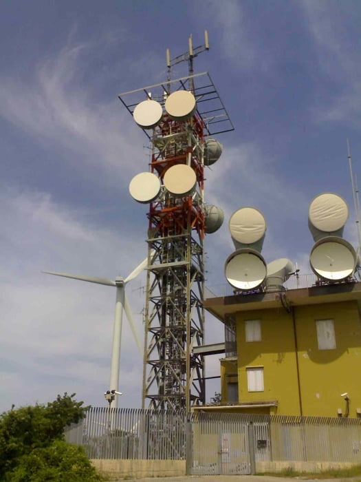
Durchs Naturschutzgebiet auf Schotter zunächst hoch bis auf 390m, dann auf Asphalt weiter über CastellinaM.Mare hoch zum Monte Vaso und dort weiter (rechts ab) zu den Windrädern und Fernmeldemasten. Aussicht bombastisch, genauso wie die Größe der Windkraftanlage, was von unten so gar nicht erkennbar ist. Leider bis Castellina denselben Weg zurück, dann weiter Richtung Cecina.
Galeria trasy
Mapa trasy i profil wysokości
Minimum height 38 m
Maximum height 671 m
Komentarze

GPS tracks
Trackpoints-
GPX / Garmin Map Source (gpx) download
-
TCX / Garmin Training Center® (tcx) download
-
CRS / Garmin Training Center® (crs) download
-
Google Earth (kml) download
-
G7ToWin (g7t) download
-
TTQV (trk) download
-
Overlay (ovl) download
-
Fugawi (txt) download
-
Kompass (DAV) Track (tk) download
-
Karta trasy (pdf) download
-
Original file of the author (gpx) download
Add to my favorites
Remove from my favorites
Edit tags
Open track
My score
Rate


