Login

Zapomniałeś swój login?

Cookies have to be accepted!
Your browser's cookie functionality is disabled. Please enable this functionality.

Not a member yet?

Register now
Login

Available for registred users only

Log in to use this feature.

Zapomniałeś swój login?

Cookies have to be accepted!
Your browser's cookie functionality is disabled. Please enable this functionality.

Not a member yet?

Register now
Filter
Kategorie
Advanced filters
  • Długość (km)
  • Wysokość
Zapisz filtr Reset filter

TrackRank

QRCode

Technical data

Długość10,6 km Wysokość9 m Way down833 m Czas trwania00:45 h:m Data23.07.2008
Oceny Author Krajobraz Czynnik zadowolenia Kondycja Technika

Statystyka

991 Widoki Oceny 28 Downloads / Pliki do pobrania Przeciętnie
Rate
  • Karta trasy
  • Dojazd
  • Downloads / Pliki do pobrania
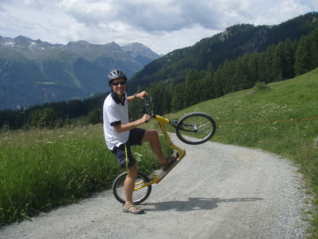
  • Trottinet = Downhill-Tour per Tretroller
  • Leihgebühr inkl. Bergfahrt mit Seilbahn 29 € (Helm auch inkl.)
  • die Fahrt runter dauert ca. 45 min
  • lustige Angelegenheit, man kann den Thrill über die Geschwindigkeit selber regulieren ;-)
  • Einkehrmöglichkeit bei Prui Hütte und in Ftan
  • schöner Blick auf gegenüberliegende Berge und ins Tal 

Further information at

http://www.engadin-adventure.ch/trottinet.html

Galeria trasy

Mapa trasy i profil wysokości

  • Open Street Map
  • Google
Minimum height 1308 m Maximum height 2160 m Widok szczegółowy

More about the tour author

roxidura
Member since 2008

Send private message

Komentarze

Anfahrt mit Zug und Auto bis Talstation Seilbahn möglich

GPS tracks

Trackpoints
  • GPX / Garmin Map Source (gpx) download
  • TCX / Garmin Training Center® (tcx) download
  • CRS / Garmin Training Center® (crs) download
  • Google Earth (kml) download
  • G7ToWin (g7t) download
  • TTQV (trk) download
  • Overlay (ovl) download
  • Fugawi (txt) download
  • Kompass (DAV) Track (tk) download
  • Karta trasy (pdf) download
  • Original file of the author (gpx) download

More about the tour author

roxidura
Member since 2008

Send private message
Share track
Add to my favorites
Remove from my favorites
Edit tags
My score
Rate
Trasa: Per Trottinet von Motta Naluns ins Tal
Rodzaj: Rower trekkingowy
Długość: 10,6 km
Evaluated on:
Czas trwania:
Day(s)
Hour(s)
Minute(s)
Ocena: Krajobraz Czynnik zadowolenia Kondycja Technika