Login

Zapomniałeś swój login?

Cookies have to be accepted!
Your browser's cookie functionality is disabled. Please enable this functionality.

Not a member yet?

Register now
Login

Available for registred users only

Log in to use this feature.

Zapomniałeś swój login?

Cookies have to be accepted!
Your browser's cookie functionality is disabled. Please enable this functionality.

Not a member yet?

Register now
Filter
Kategorie
Advanced filters
  • Długość (km)
  • Wysokość
Zapisz filtr Reset filter

TrackRank

QRCode

Technical data

Długość51,7 km Wysokość673 m Way down678 m Czas trwania03:07 h:m Data29.07.2008
Oceny Author User Krajobraz Czynnik zadowolenia Kondycja Technika

Statystyka

1283 Widoki 4 Oceny 275 Downloads / Pliki do pobrania 4.00 Przeciętnie
Rate
  • Karta trasy
  • Dojazd
  • Downloads / Pliki do pobrania

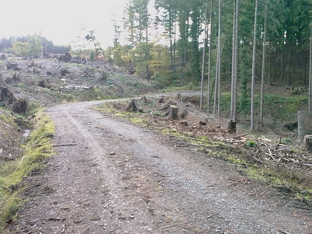
Tour entlang der alten Höhenwege.

Die Beiden Höhenwege sind zwar Hauptwanderwege aber nicht durchweg Wanderautobahnen. Zwischendurch gibt es hier riesige Schlammlöcher, die aber bei trockenem Wetter über Seitentrails umfahren werden können. Hier hat man dann lediglich mit einigen Wurzeln zu kämpfen. Überwiegend geht die Tour aber über breite Wald- und Forstwege.

Galeria trasy

Mapa trasy i profil wysokości

  • Open Street Map
  • Google
Minimum height 167 m Maximum height 444 m Widok szczegółowy

More about the tour author

frankwacker
Member since 2008

Send private message

Komentarze

hagedorn on 11.05.2009

tolle tour !!

Tolle Tour , danke an den Autor

p.s. bei nassem untergrund sollte min.Nobby Nic drauf !!
Legosteniker on 02.05.2010

Schöne Strecke

Hai, bin die Strecke heute Teilweise abgefahren. leider 2 x mit Gewitter/Regen daher waren die Baumwurzel doch arg glitschig. Und der Schlamm war auch nicht schlecht.
brinkhoff on 07.08.2011

Schöne Strecke

Tolle Tour
Niederense erreicht man von der Autobahn Abfahrt Neheim. Richtung Möhnesee fahren. Der Parkplatz im Aupketal direkt hinter Neheim kann auch als Ausgangspunkt genutzt werden.

GPS tracks

Trackpoints
  • GPX / Garmin Map Source (gpx) download
  • TCX / Garmin Training Center® (tcx) download
  • CRS / Garmin Training Center® (crs) download
  • Google Earth (kml) download
  • G7ToWin (g7t) download
  • TTQV (trk) download
  • Overlay (ovl) download
  • Fugawi (txt) download
  • Kompass (DAV) Track (tk) download
  • Karta trasy (pdf) download
  • Original file of the author (gpx) download

More about the tour author

frankwacker
Member since 2008

Send private message
Share track
Add to my favorites
Remove from my favorites
Edit tags
My score
Rate
Trasa: Rennweg Plackweg Möhnesee
Rodzaj: Rower górski (MTB)
Długość: 51,7 km
Evaluated on:
Czas trwania:
Day(s)
Hour(s)
Minute(s)
Ocena: Krajobraz Czynnik zadowolenia Kondycja Technika