


Der bekannte HW1 als GPS Download
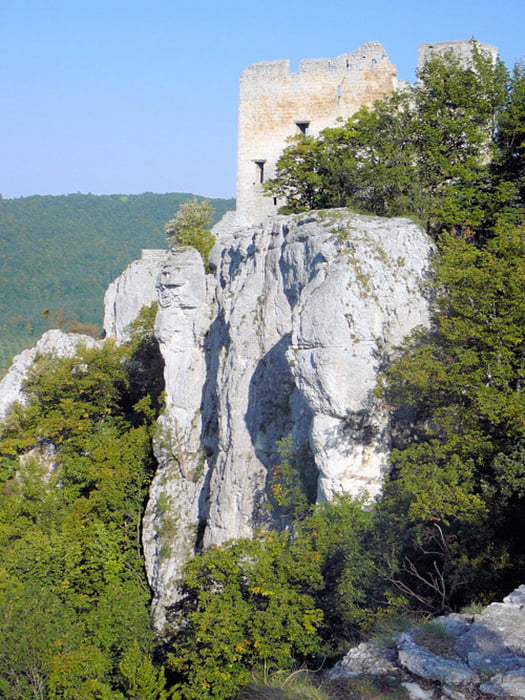
Hervorragende Aussichtspunkte, interessante Felsformationen, zahlreiche Burgen, Ruinen und Höhlen sind die Glanzlichter dieses Weges entlang dem Albtrauf.
Der Nordrandweg ist der älteste und zugleich wohl schönste der Hauptwanderwege des Schwäbischen Albvereins. Von Donauwörth ausgehend führt er entlang des Nordrands der Alb über 339 km nach Tuttlingen. Von hoch auftragenden Felsen und markanten, oft von Burgen und Ruinen gekrönten Bergen bietet er großartige Ausblicke auf das Albvorland
Verlauf: Donauwörth - Bopfingen - Heubach - Burg Teck - Bad Urach - Lichtenstein - Nebelhöhle - Roßberg - Jungingen - Raichberg - Albstadt/Laufen - Dreifaltigkeitsberg - Tuttlingen
Die Tour ist sicher in 5-6 Tagen zu schaffen, eine interessante Alternative zu einer Alpenüberquerung allemal.
Zur Steigerung gäbs noch die Möglichkeit auf dem HW2 wieder zurück zu fahren
Galeria trasy

Mapa trasy i profil wysokości
Minimum height 99999 m
Maximum height -99999 m
More about the tour author

|
tommy777 |
Komentarze

Die Tour kann natürlich entweder in Tuttlingen oder in Donauwörth gstartet werden.
In Donauwörth Auto parken
GPS tracks
Trackpoints-
GPX / Garmin Map Source (gpx) download
-
TCX / Garmin Training Center® (tcx) download
-
CRS / Garmin Training Center® (crs) download
-
Google Earth (kml) download
-
G7ToWin (g7t) download
-
TTQV (trk) download
-
Overlay (ovl) download
-
Fugawi (txt) download
-
Kompass (DAV) Track (tk) download
-
Karta trasy (pdf) download
-
Original file of the author (gpx) download
More about the tour author
|
|
tommy777 |
Add to my favorites
Remove from my favorites
Edit tags
Open track
My score
Rate