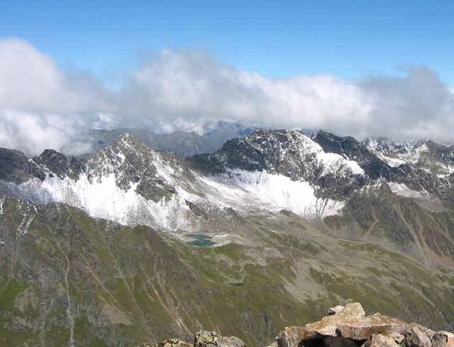
Aufstieg von der Franz Senn Huette auf die Rinnenspitze. Engegen des Normalweges erfolgt der erste Teil des Aufstiegs ueber den (besonders mit Rucksack nicht ganz einfachen) Edelweiss-Klettersteig. Bei gutem Wetter hat man eine sehr schoene Aussicht auf der Rinnenspitze.
Trackfile copyright under Creative Commons (By attribution, share alike). See: http://creativecommons.org/licenses/by-sa/2.5/
Karte: DAV 31/2 (Stubaier Alpen / Sellarin)
Trackfile copyright under Creative Commons (By attribution, share alike). See: http://creativecommons.org/licenses/by-sa/2.5/
Karte: DAV 31/2 (Stubaier Alpen / Sellarin)
Galeria trasy
Mapa trasy i profil wysokości
Minimum height 2148 m
Maximum height 2995 m
Komentarze
Franz Senn Huette, 2147m, http://www.franzsennhuette.at
Aufstieg siehe Tour 2110: "Aufstieg zur Franz Senn Huette"
Anfahrt: Innsbruck, Brenner-Autobahn, Abfahrt Stubaital. Dann nach Neustift, Milders, Sedugg, Obberiesalm.
Aufstieg siehe Tour 2110: "Aufstieg zur Franz Senn Huette"
Anfahrt: Innsbruck, Brenner-Autobahn, Abfahrt Stubaital. Dann nach Neustift, Milders, Sedugg, Obberiesalm.
GPS tracks
Trackpoints-
GPX / Garmin Map Source (gpx) download
-
TCX / Garmin Training Center® (tcx) download
-
CRS / Garmin Training Center® (crs) download
-
Google Earth (kml) download
-
G7ToWin (g7t) download
-
TTQV (trk) download
-
Overlay (ovl) download
-
Fugawi (txt) download
-
Kompass (DAV) Track (tk) download
-
Karta trasy (pdf) download
-
Original file of the author (g7t) download
Add to my favorites
Remove from my favorites
Edit tags
Open track
My score
Rate


coole Variante
Video