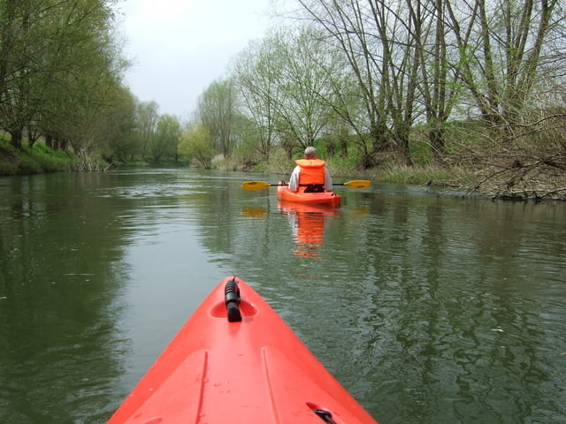
Romantische Kanutour von der Kessler-Mühle zum Campingplatz in Hamm-Uentrop. Einsetzen an der Einsetzstelle vor dem alten Wehr in Kessler. Dann kurz gegen die Strömung und Wechsel zu anderen Uferseite, um dann mit der Strömung durch die Bootsgasse am Wehr vorbeizufahren. Danach gibt es auf dieser Strecke keine Gefahrenstellen oder Hindernisse. Daher eine romantische Tour mit nicht sehr hoher Fließgeschwindigkeit. Ideal für Einsteiger und Familien. Aussetzen am Campingplatz in Hamm-Uentrop. Falls das Auto direkt bis zur Aussetzstelle auf dem Campingplatz-Gelände gefahren werden soll so kostet dies 1 EUR (in der Reception melden). Ansonsten kann man die Boote auch kurz über den Platz bis zum Parkplatz tragen.
Galeria trasy
Mapa trasy i profil wysokości
Minimum height 62 m
Maximum height 70 m
Komentarze

Von der BAB A2 Abfahrt Hamm-Uentrop Richtung Lippborg, dann weiter Richtung Lippetal Herzfeld. Vor Herzfeld abbiegen zur Kessler Mühle (an der Straße ausgeschildert).
GPS tracks
Trackpoints-
GPX / Garmin Map Source (gpx) download
-
TCX / Garmin Training Center® (tcx) download
-
CRS / Garmin Training Center® (crs) download
-
Google Earth (kml) download
-
G7ToWin (g7t) download
-
TTQV (trk) download
-
Overlay (ovl) download
-
Fugawi (txt) download
-
Kompass (DAV) Track (tk) download
-
Karta trasy (pdf) download
-
Original file of the author (gpx) download
Add to my favorites
Remove from my favorites
Edit tags
Open track
My score
Rate


