Login

Zapomniałeś swój login?

Cookies have to be accepted!
Your browser's cookie functionality is disabled. Please enable this functionality.

Not a member yet?

Register now
Login

Available for registred users only

Log in to use this feature.

Zapomniałeś swój login?

Cookies have to be accepted!
Your browser's cookie functionality is disabled. Please enable this functionality.

Not a member yet?

Register now
Filter
Kategorie
Advanced filters
  • Długość (km)
  • Wysokość
Zapisz filtr Reset filter

TrackRank

QRCode

Technical data

Długość53,1 km Wysokość1535 m Way down1548 m Czas trwania03:54 h:m Data24.08.2008
Oceny Author User Krajobraz Czynnik zadowolenia Kondycja Technika

Statystyka

905 Widoki 1 Ocena 172 Downloads / Pliki do pobrania 4.00 Przeciętnie
Rate
  • Karta trasy
  • Dojazd
  • Downloads / Pliki do pobrania
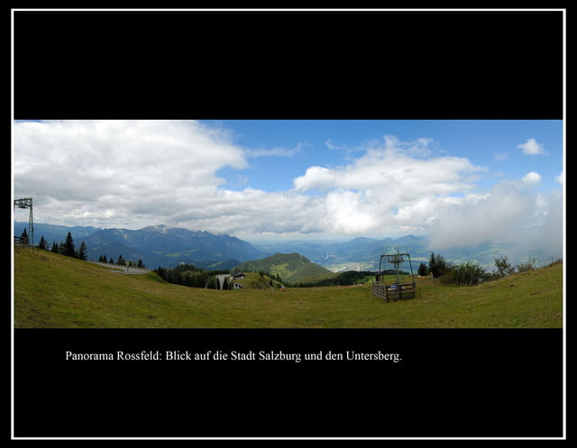
Von Salzburg über Grödig nach Markt Schellenberg. Von dort auf Nebenstrassen nach Oberau und weiter über die Roßfeldstrasse auf das Roßfeld. Speziell am Wochenende ein beliebtes Reiseziel und stark frequentierte Motorradstrecke zumindest zwischen Oberau, dem Plateau und bergab bis Gmerk. Dann wieder Seitenstrassen bis nach Hallein und auf Radwegen zurück nach Salzburg. Die Tour bietet schöne Ausblicke auf den Untersberg, den Kehlstein und auf die Stadt Salzburg samt Umgebung.

Galeria trasy

Mapa trasy i profil wysokości

  • Open Street Map
  • Google
Minimum height 433 m Maximum height 1541 m Widok szczegółowy

More about the tour author

theKurt
Member since 2008

Send private message

Komentarze

GPS tracks

Trackpoints
  • GPX / Garmin Map Source (gpx) download
  • TCX / Garmin Training Center® (tcx) download
  • CRS / Garmin Training Center® (crs) download
  • Google Earth (kml) download
  • G7ToWin (g7t) download
  • TTQV (trk) download
  • Overlay (ovl) download
  • Fugawi (txt) download
  • Kompass (DAV) Track (tk) download
  • Karta trasy (pdf) download
  • Original file of the author (gpx) download

More about the tour author

theKurt
Member since 2008

Send private message
Share track
Add to my favorites
Remove from my favorites
Edit tags
My score
Rate
Trasa: Von Salzburg auf das Roßfeld.
Rodzaj: Rower górski (MTB)
Długość: 53,1 km
Evaluated on:
Czas trwania:
Day(s)
Hour(s)
Minute(s)
Ocena: Krajobraz Czynnik zadowolenia Kondycja Technika