


Tolle Panoramastrecke auf den Monte Faudo
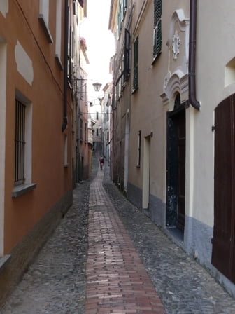
Von Imperia aus geht`s die Küstenstraße (SP1) entlang nach San Lorenzo Al Mare, biegt dort rechts auf die SP44 ab, und folgt dieser durch malerische Olivenhaine bis in das kleine Bergdörfchen Civezza. Wenn man die engen Gassen passiert hat, biegt man etwas oberhalb von Civezza links auf die SP79 ab. Der Straße folgt man bis zu einer alten Kapelle. Dort beginnt ein mit Ginstersträuchern gesäumter Forstweg, der bis zum Gipfel des Monte Faudo führt.
Auf der gesamten Strecke hat man eine wunderbare Aussicht auf kleine Bergdörfer und die Küste der Riviera.
Galeria trasy


Mapa trasy i profil wysokości
Minimum height 8 m
Maximum height 1011 m
More about the tour author
|
|
jackpot |
Komentarze

Von der Autobahn A10 (Genua/Nizza) bei der Ausfahrt Imperia Ovest abfahren einen beliebigen Parkplatz suchen und los geht's.
GPS tracks
Trackpoints-
GPX / Garmin Map Source (gpx) download
-
TCX / Garmin Training Center® (tcx) download
-
CRS / Garmin Training Center® (crs) download
-
Google Earth (kml) download
-
G7ToWin (g7t) download
-
TTQV (trk) download
-
Overlay (ovl) download
-
Fugawi (txt) download
-
Kompass (DAV) Track (tk) download
-
Karta trasy (pdf) download
-
Original file of the author (gpx) download
More about the tour author
|
|
jackpot |
Add to my favorites
Remove from my favorites
Edit tags
Open track
My score
Rate