


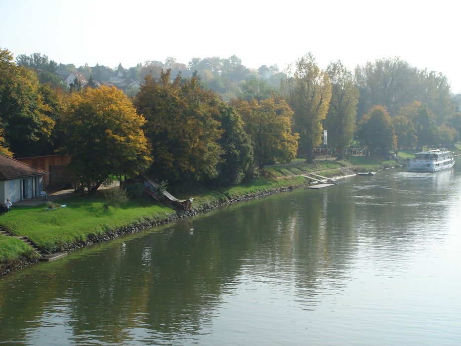
Eine herrliche Tour auf der Höhe des Neckars bzw. der Murr. Auf der Höhe von Benningen ist die Mündung der Murr in den Neckar zu sehen. Die Tour geht weiter über den Ort Murr nach Marbach über die Aussichtsplattform "Galgen". In Marbach überqueren wir die neuerbaute Füßgängerbrücke über den Neckar und laufen dann zurück über Benningen zu unserem Ausgangspunkt am Neckarkanal in Freiberg.
Further information at
http://www.schillerstadt-marbach.de/Galeria trasy
Mapa trasy i profil wysokości
Minimum height 192 m
Maximum height 285 m
More about the tour author
|
|
jok |
Komentarze

Der Start und Ende der Nordic Walking Tourist am Wanderparkplatz beim Neckarkanal in Freiberg.
GPS tracks
Trackpoints-
GPX / Garmin Map Source (gpx) download
-
TCX / Garmin Training Center® (tcx) download
-
CRS / Garmin Training Center® (crs) download
-
Google Earth (kml) download
-
G7ToWin (g7t) download
-
TTQV (trk) download
-
Overlay (ovl) download
-
Fugawi (txt) download
-
Kompass (DAV) Track (tk) download
-
Karta trasy (pdf) download
-
Original file of the author (gpx) download
More about the tour author
|
|
jok |
Add to my favorites
Remove from my favorites
Edit tags
Open track
My score
Rate