Login

Zapomniałeś swój login?

Cookies have to be accepted!
Your browser's cookie functionality is disabled. Please enable this functionality.

Not a member yet?

Register now
Login

Available for registred users only

Log in to use this feature.

Zapomniałeś swój login?

Cookies have to be accepted!
Your browser's cookie functionality is disabled. Please enable this functionality.

Not a member yet?

Register now
Filter
Kategorie
Advanced filters
  • Długość (km)
  • Wysokość
Zapisz filtr Reset filter

TrackRank

QRCode

Technical data

Długość38,8 km Wysokość368 m Way down365 m Czas trwania03:30 h:m Data14.10.2008
Oceny Author Krajobraz Czynnik zadowolenia Kondycja Technika

Statystyka

3921 Widoki Oceny 167 Downloads / Pliki do pobrania Przeciętnie
Rate
  • Karta trasy
  • Dojazd
  • Downloads / Pliki do pobrania
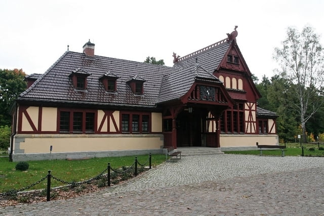
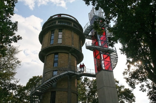
Wir haben die Tour in Althüttenorf begonnen. Andere Startorte sind möglich. Die Tour führt ein Stück an einer Straße entlang, also bitte Kinder in die Mitte, vorzugsweise Warnweste für den Ersten und den Letzten! Ansonsten genügt ein einfaches Fahrrad mir Gangschaltung. Empfehlenswert ist der Besuch des Kaiserbahnhofs und des Wasserturms in Joachimsthal. Der Askanierturm an der Südspitze des Sees ist ebenfalls sehr sehenswert.

Galeria trasy

Mapa trasy i profil wysokości

  • Open Street Map
  • Google
Minimum height 42 m Maximum height 124 m Widok szczegółowy

More about the tour author

Sammy Raider

Komentarze

A11 Abfahrt Joachimsthal

GPS tracks

Trackpoints
  • GPX / Garmin Map Source (gpx) download
  • TCX / Garmin Training Center® (tcx) download
  • CRS / Garmin Training Center® (crs) download
  • Google Earth (kml) download
  • G7ToWin (g7t) download
  • TTQV (trk) download
  • Overlay (ovl) download
  • Fugawi (txt) download
  • Kompass (DAV) Track (tk) download
  • Karta trasy (pdf) download
  • Original file of the author (gpx) download

More about the tour author

Sammy Raider

Share track
Add to my favorites
Remove from my favorites
Edit tags
My score
Rate
Trasa: Rund um den Werbellinsee
Rodzaj: Trasy rowerowe
Długość: 38,8 km
Evaluated on:
Czas trwania:
Day(s)
Hour(s)
Minute(s)
Ocena: Krajobraz Czynnik zadowolenia Kondycja Technika