Login

Zapomniałeś swój login?

Cookies have to be accepted!
Your browser's cookie functionality is disabled. Please enable this functionality.

Not a member yet?

Register now
Login

Available for registred users only

Log in to use this feature.

Zapomniałeś swój login?

Cookies have to be accepted!
Your browser's cookie functionality is disabled. Please enable this functionality.

Not a member yet?

Register now
Filter
Kategorie
Advanced filters
  • Długość (km)
  • Wysokość
Zapisz filtr Reset filter

TrackRank

QRCode

Technical data

Długość38,7 km Wysokość437 m Way down446 m Czas trwania00:00 h:m Data29.12.2005
Oceny Author Krajobraz Czynnik zadowolenia Kondycja Technika

Statystyka

1449 Widoki 3 Oceny 260 Downloads / Pliki do pobrania 2.67 Przeciętnie
Rate
  • Karta trasy
  • Dojazd
  • Downloads / Pliki do pobrania
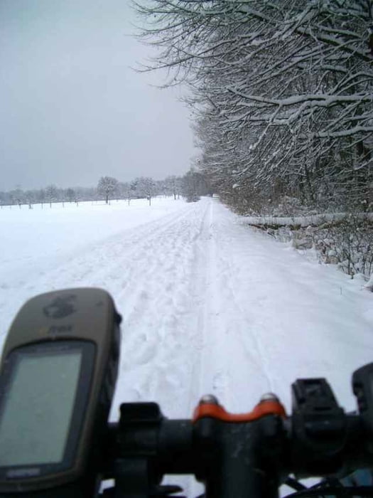
Die Tour beginnt in Sielmingen bei der Kirche und führt nach Aich und durch das Schaichtal hinauf zum Betzenberg. Nun Abfahrt ins Aichtal und weiter durch das Siebenmühlental und über Echterdingen und Bernhausen zurück nach Sielmingen. Technik 2 Sterne wegen geschlossener Schneedecke.

Mapa trasy i profil wysokości

  • Open Street Map
  • Google
Minimum height 311 m Maximum height 497 m Widok szczegółowy

More about the tour author

HENNING
Member since 2004

Send private message

Komentarze

Andreas Jung on 06.04.2006

Landschaftlich überwiegend schöne Tour, die sich auch gut mit einem Trekking-Bike
bewältigen lässt
Oliver Auberlen on 07.04.2006

Sehr schöne und abwechslungsreiche Tour, ist bestimmt auch in umgekehrter Richtung interessant.
Jason on 22.09.2006

Bewertung

Eine nette Runde für zwischendurch, nach dem Feierabend o.ä. Die komplette Bewertung finde ich allerdings jeweils um einen Stern zu hoch gegriffen.

GPS tracks

Trackpoints
  • GPX / Garmin Map Source (gpx) download
  • TCX / Garmin Training Center® (tcx) download
  • CRS / Garmin Training Center® (crs) download
  • Google Earth (kml) download
  • G7ToWin (g7t) download
  • TTQV (trk) download
  • Overlay (ovl) download
  • Fugawi (txt) download
  • Kompass (DAV) Track (tk) download
  • Karta trasy (pdf) download
  • Original file of the author (g7t) download

More about the tour author

HENNING
Member since 2004

Send private message
Share track
Add to my favorites
Remove from my favorites
Edit tags
My score
Rate
Trasa: Winterride
Rodzaj: Rower górski (MTB)
Długość: 38,7 km
Evaluated on:
Czas trwania:
Day(s)
Hour(s)
Minute(s)
Ocena: Krajobraz Czynnik zadowolenia Kondycja Technika