Login

Zapomniałeś swój login?

Cookies have to be accepted!
Your browser's cookie functionality is disabled. Please enable this functionality.

Not a member yet?

Register now
Login

Available for registred users only

Log in to use this feature.

Zapomniałeś swój login?

Cookies have to be accepted!
Your browser's cookie functionality is disabled. Please enable this functionality.

Not a member yet?

Register now
Filter
Kategorie
Advanced filters
  • Długość (km)
  • Wysokość
Zapisz filtr Reset filter

TrackRank

QRCode

Technical data

Długość46,1 km Wysokość0 m Way down0 m Czas trwania04:00 h:m Data06.01.2006
Oceny Author Krajobraz Czynnik zadowolenia Kondycja Technika

Statystyka

4459 Widoki 2 Oceny 545 Downloads / Pliki do pobrania 3.00 Przeciętnie
Rate
  • Karta trasy
  • Dojazd
  • Downloads / Pliki do pobrania

Tour durch den rheinischen Westerwald. Start und Ziel an den Tennisplätzen in Rengsdorf.
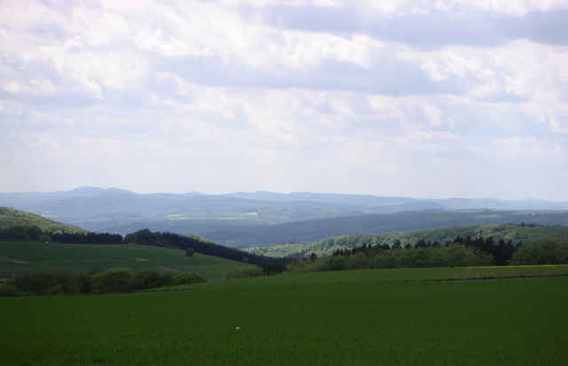
Abwechslungsreiche Strecke mit tollen Aussichten und dichten Wäldern.

Viel Spaß auf tollen Touren!

Further information at

http://www.mtb-rengsdorf.de

Galeria trasy

Mapa trasy i profil wysokości

  • Open Street Map
  • Google
Minimum height 99999 m Maximum height 2147483647 m Widok szczegółowy

More about the tour author

Klaus Goerg
Member since 2005

Send private message

Komentarze

Andrey Stupak on 11.12.2006

Sehr schöne Tour

Auch im Winter fahrbar. Schöne Aussichten während der ersten Hälfte. Im Winter müsste man aber für die Fahrtechnik vier Sterne vergeben, und auf die Reifen mit großen Stollen (viel Schlamm) nicht verzichten.
waldmeister2 on 20.10.2013

schöööööön!!!!

schöne Strecke die Lust auf mehr macht.Da wir das erste Mal mit der Suonto Ambit unterwegs waren war es mitunter "spannend" den richtigen Weg zu finden.
Anfänger sollten ca.eine Std.Orientierungszeit einplanen.

56579 Rengsdorf bei Neuwied.

Aus Richtung A3 kommend am Ortseingang die erste Straße rechts und der Beschilderung zur Tennisterrasse folgen.

Aus Neuwied kommend am Ortsausgang links zu den Tennisplätzen.


Parkplätze sind am Wald vorhanden.

GPS tracks

Trackpoints
  • GPX / Garmin Map Source (gpx) download
  • TCX / Garmin Training Center® (tcx) download
  • CRS / Garmin Training Center® (crs) download
  • Google Earth (kml) download
  • G7ToWin (g7t) download
  • TTQV (trk) download
  • Overlay (ovl) download
  • Fugawi (txt) download
  • Kompass (DAV) Track (tk) download
  • Karta trasy (pdf) download
  • Original file of the author (g7t) download

More about the tour author

Klaus Goerg
Member since 2005

Send private message
Share track
Add to my favorites
Remove from my favorites
Edit tags
My score
Rate
Trasa: Touren im rheinischen Westerwald 2
Rodzaj: Rower górski (MTB)
Długość: 46,1 km
Evaluated on:
Czas trwania:
Day(s)
Hour(s)
Minute(s)
Ocena: Krajobraz Czynnik zadowolenia Kondycja Technika