
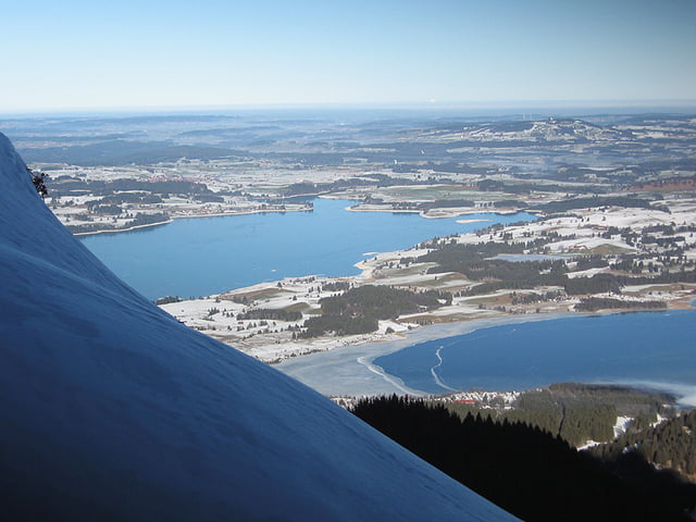

Schöne Tour auf den Tegelberg mit herrlichem Ausblick.
Teilweise steile Anstiege für die schon etwas Kraft und Kondition nötig ist. Da bei der Aufzeichnung der GPS-Daten kein Alpinskibetrieb war bin ich durchwegs auf der Skipiste gegangen, bei Skibetrieb sollten aber bis zur Rohrkopfhütte die ausgeschilderten Tourenwege benutzt werden, nach Liftbetriebsende empfiehlt es sich auch immer ganz am Pistenrand zu gehen, ebenso bei der Abfahrt am Rand fahren sonst macht man Bekanntschaft mit dem meist schlecht gelaunten Pistenraupenfahrer.
Einmal pro Woche hat die Hütte länger (bis 22 Uhr geöffnet) dies ist auch offizieller Tourengehertag, hierzu bitte Hinweise auf entsprechenden Internetseiten z.B. Alpenverein nachlesen.
Galeria trasy


Mapa trasy i profil wysokości
Minimum height 732 m
Maximum height 1715 m
More about the tour author
|
|
Ritzelflitzer |
Komentarze

GPS tracks
Trackpoints-
GPX / Garmin Map Source (gpx) download
-
TCX / Garmin Training Center® (tcx) download
-
CRS / Garmin Training Center® (crs) download
-
Google Earth (kml) download
-
G7ToWin (g7t) download
-
TTQV (trk) download
-
Overlay (ovl) download
-
Fugawi (txt) download
-
Kompass (DAV) Track (tk) download
-
Karta trasy (pdf) download
-
Original file of the author (gpx) download
More about the tour author
|
|
Ritzelflitzer |
Add to my favorites
Remove from my favorites
Edit tags
Open track
My score
Rate