Login

Zapomniałeś swój login?

Cookies have to be accepted!
Your browser's cookie functionality is disabled. Please enable this functionality.

Not a member yet?

Register now
Login

Available for registred users only

Log in to use this feature.

Zapomniałeś swój login?

Cookies have to be accepted!
Your browser's cookie functionality is disabled. Please enable this functionality.

Not a member yet?

Register now
Filter
Kategorie
Advanced filters
  • Długość (km)
  • Wysokość
Zapisz filtr Reset filter

TrackRank

QRCode

Technical data

Długość8,5 km Wysokość268 m Way down264 m Czas trwania02:00 h:m Data08.02.2009
Oceny Author User Krajobraz Czynnik zadowolenia Kondycja Technika

Statystyka

10544 Widoki 3 Oceny 1129 Downloads / Pliki do pobrania 4.33 Przeciętnie
Rate
  • Karta trasy
  • Dojazd
  • Downloads / Pliki do pobrania
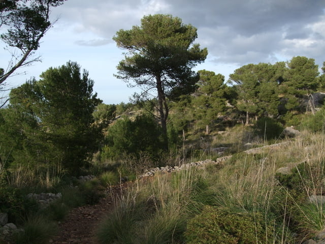
Einfache Rundwanderung von Port de Soller über den Leuchturm am Cap Gros. Der Weg führt durch eine abwechslungsreiche Landschaft mit einer üppigen Vegetation und einer interessanten Tierwelt.

Further information at

http://de.wikipedia.org/wiki/S%C3%B3ller

Galeria trasy

Mapa trasy i profil wysokości

  • Open Street Map
  • Google
Minimum height -22 m Maximum height 195 m Widok szczegółowy

More about the tour author

osnapicture
Member since 2009

Send private message

Komentarze

asbach63 on 26.04.2009

Tour mit wunderbaren Aussichten

Wir haben die Tour gemacht und können diese nur empfehlen. Die Aussichten auf die Bucht von Soller sind einfach genial. Einziger Wermutstropfen sind die Parkgebühren in Soller. Es gibt am Nachmittag selbst in der Vorsaison im April keine kostenlosen Plätze!
Von Palma mit dem Überlandbus oder der historischen Schmalspurbahn

GPS tracks

Trackpoints
  • GPX / Garmin Map Source (gpx) download
  • TCX / Garmin Training Center® (tcx) download
  • CRS / Garmin Training Center® (crs) download
  • Google Earth (kml) download
  • G7ToWin (g7t) download
  • TTQV (trk) download
  • Overlay (ovl) download
  • Fugawi (txt) download
  • Kompass (DAV) Track (tk) download
  • Karta trasy (pdf) download
  • Original file of the author (gpx) download

More about the tour author

osnapicture
Member since 2009

Send private message
Share track
Add to my favorites
Remove from my favorites
Edit tags
My score
Rate
Trasa: Rundwanderung Port de Soller
Rodzaj: Wędrówki
Długość: 8,5 km
Evaluated on:
Czas trwania:
Day(s)
Hour(s)
Minute(s)
Ocena: Krajobraz Czynnik zadowolenia Kondycja Technika