


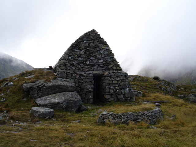
Beginnend auf in Hinterwald geht es erstmals gut 2 Stunden über einen Forstweg bis zur unteren Glattalm. Von da beginnt der eigentliche Wanderweg zum Glattjoch. Zu Römerszeiten war hier ein Römerweg zum Transport von Waren, aber hauptsächlich für Salz. Ginge man auf der anderen Seite wieder hinunter käme man nach Oberwölz. Am Sattel findet man eine wieder aufgebaute Kapelle (1995-1997). Die St. Virgil Kapelle, erbaut wahrscheinlich im 9.-10. Jh von irischen Mönchen.
Further information at
http://www.donnersbachwald.atGaleria trasy
Mapa trasy i profil wysokości
Minimum height 1068 m
Maximum height 1989 m
More about the tour author

|
Komentarze

N47 21.414 E14 09.119
GPS tracks
Trackpoints-
GPX / Garmin Map Source (gpx) download
-
TCX / Garmin Training Center® (tcx) download
-
CRS / Garmin Training Center® (crs) download
-
Google Earth (kml) download
-
G7ToWin (g7t) download
-
TTQV (trk) download
-
Overlay (ovl) download
-
Fugawi (txt) download
-
Kompass (DAV) Track (tk) download
-
Karta trasy (pdf) download
More about the tour author
|
|
Add to my favorites
Remove from my favorites
Edit tags
Open track
My score
Rate