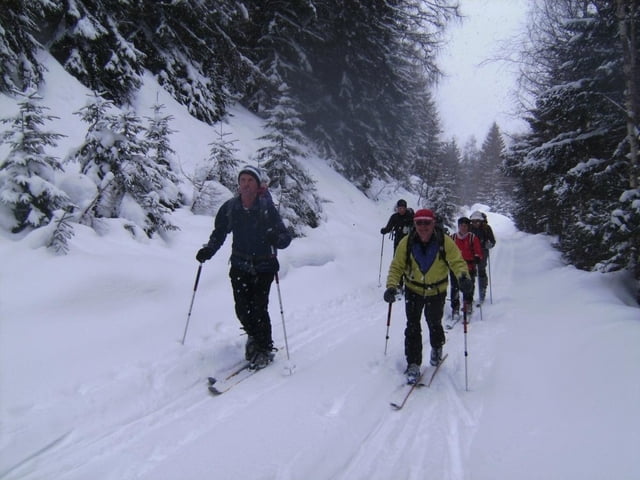
Eine sichere Hochwintertour, überwiegend im Wald, im Almgelände und auf einem Gratrücken.
Wir starteten an der Sölkpassstraße in Großsölk. Parkmöglichkeit an der Einmündung für höchstens 6 Fahrzeuge. Wenn geräumt ist, besteht die Möglichkeit, bis zu einem kleinen PP vor dem Sperrschild (Höhe 1020m) zu fahren.
Auf der Forststraße weiter, immer wieder kleine Abkürzungen (Sommerweg) bis zum Almgelände bei der Schönwetterhütte (meist offen) und weiter über Gumpenalm und nach einer weiteren Alm auf den Rücken, der zur Blockfeldspitze führt. Von dort in östl. Richtung zum 2226 m hohen Gipfel. Er blieb uns verwehrt, wir kamen nur bis ca. 30 Hm vor die Blockfeldspitze (Sturm, Nebel, Schneetreiben, abgewehter Grat). Der Weiterweg ist aber vorgegeben.
Bei der Abfahrt hatte ich das GPS (Garmin Vista Cx) in der Bekleidung, deshalb ab 1300 m unvollständige Aufzeichnung. Man braucht nicht im Wald an der Aufstiegsspur abfahren!
Eine Bewertung der landschaftlichen Schönheit kann nicht erfolgen (keine Sicht!)
Further information at
http://www.dav-teisendorf.de/berichte/av_touren/2009/soelktal/index.htmGaleria trasy
Mapa trasy i profil wysokości
Komentarze

GPS tracks
Trackpoints-
GPX / Garmin Map Source (gpx) download
-
TCX / Garmin Training Center® (tcx) download
-
CRS / Garmin Training Center® (crs) download
-
Google Earth (kml) download
-
G7ToWin (g7t) download
-
TTQV (trk) download
-
Overlay (ovl) download
-
Fugawi (txt) download
-
Kompass (DAV) Track (tk) download
-
Karta trasy (pdf) download
-
Original file of the author (gpx) download


