Login

Zapomniałeś swój login?

Cookies have to be accepted!
Your browser's cookie functionality is disabled. Please enable this functionality.

Not a member yet?

Register now
Login

Available for registred users only

Log in to use this feature.

Zapomniałeś swój login?

Cookies have to be accepted!
Your browser's cookie functionality is disabled. Please enable this functionality.

Not a member yet?

Register now
Filter
Kategorie
Advanced filters
  • Długość (km)
  • Wysokość
Zapisz filtr Reset filter

TrackRank

QRCode

Technical data

Długość10,6 km Wysokość836 m Way down801 m Czas trwania04:30 h:m Data03.03.2009
Oceny Author Krajobraz Czynnik zadowolenia Kondycja Technika

Statystyka

2609 Widoki Oceny 180 Downloads / Pliki do pobrania Przeciętnie
Rate
  • Karta trasy
  • Dojazd
  • Downloads / Pliki do pobrania

Die Tour wurde am 27.10.2008 mit einem Garmin etrex Vista HCx aufgezeichnet.

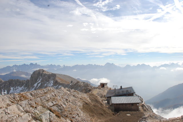
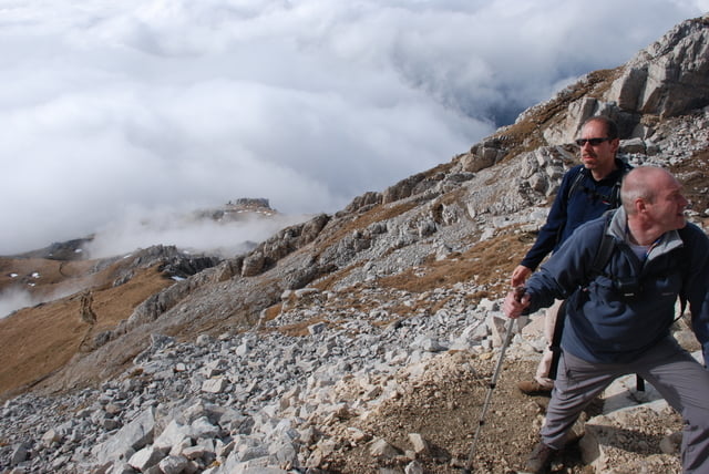
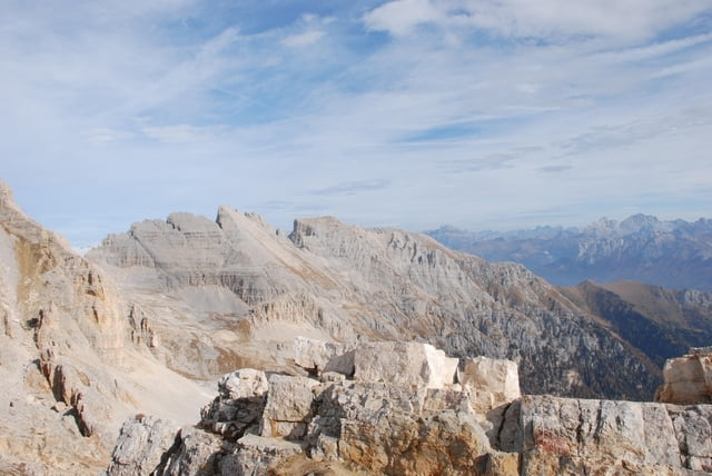
Sehr schöne Bergtour, dicht an Felstürmen vorbei mit phantastischem Blick bei gutem Wetter. 

Pause auf der Latemarhütte/Refugio Torre Di Pisa und zurück über die Gamsstallscharte.


Galeria trasy

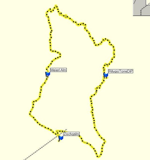
Mapa trasy i profil wysokości

  • Open Street Map
  • Google
Minimum height 1970 m Maximum height 2691 m Widok szczegółowy

More about the tour author

mausbiberle
Member since 2008

Send private message

Komentarze

Anfahrt mit dem Auto von Obereggen oder Pampeago bis zur Zischgalm auf 2000m

- Start und Ziel


GPS tracks

Trackpoints
  • GPX / Garmin Map Source (gpx) download
  • TCX / Garmin Training Center® (tcx) download
  • CRS / Garmin Training Center® (crs) download
  • Google Earth (kml) download
  • G7ToWin (g7t) download
  • TTQV (trk) download
  • Overlay (ovl) download
  • Fugawi (txt) download
  • Kompass (DAV) Track (tk) download
  • Karta trasy (pdf) download
  • Original file of the author (gpx) download

More about the tour author

mausbiberle
Member since 2008

Send private message
Share track
Add to my favorites
Remove from my favorites
Edit tags
My score
Rate
Trasa: Zischgalm-Latemarhütte-Gamsstallscharte-Meierlalm
Rodzaj: Trasy górskie
Długość: 10,6 km
Evaluated on:
Czas trwania:
Day(s)
Hour(s)
Minute(s)
Ocena: Krajobraz Czynnik zadowolenia Kondycja Technika