
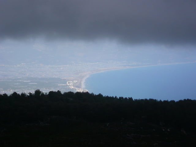

Hier gehts nun also zur Sache, auf 19km gehts 1700hm bergauf und das bei teilweise sehr grobschottrigen Wegen. Vor allem im März/April muss mit widrigen Wetterverhältnissen ab ca. 1000hm gerechnet werden, da der feuchte vom Meer kommende Wind kondensiert und ab 1300hm als Schnee bzw. Graupel niedergeht.
Ab 1500hm ist mit Scheefeldern zurechnen und den dem entsprechend langen Fahrzeiten.
Uns hat es erwischt und wir mussten 2std. im Schnee schieben, also auf alle Fälle Überschuhe und warme Kleidung mitnehmen. Alternativ kann auch über die D400 gefahren werden, aber die Anstrengungen über den Berg lohnen sich Landschaftlich allemal.
Galeria trasy


Mapa trasy i profil wysokości
Minimum height -6 m
Maximum height 1642 m
More about the tour author

|
chieftain |
Komentarze

GPS tracks
Trackpoints-
GPX / Garmin Map Source (gpx) download
-
TCX / Garmin Training Center® (tcx) download
-
CRS / Garmin Training Center® (crs) download
-
Google Earth (kml) download
-
G7ToWin (g7t) download
-
TTQV (trk) download
-
Overlay (ovl) download
-
Fugawi (txt) download
-
Kompass (DAV) Track (tk) download
-
Karta trasy (pdf) download
-
Original file of the author (gpx) download
More about the tour author
|
|
chieftain |
Add to my favorites
Remove from my favorites
Edit tags
Open track
My score
Rate