Login

Zapomniałeś swój login?

Cookies have to be accepted!
Your browser's cookie functionality is disabled. Please enable this functionality.

Not a member yet?

Register now
Login

Available for registred users only

Log in to use this feature.

Zapomniałeś swój login?

Cookies have to be accepted!
Your browser's cookie functionality is disabled. Please enable this functionality.

Not a member yet?

Register now
Filter
Kategorie
Advanced filters
  • Długość (km)
  • Wysokość
Zapisz filtr Reset filter

TrackRank

QRCode

Technical data

Długość32,2 km Wysokość1090 m Way down1088 m Czas trwania03:30 h:m Data25.04.2009
Oceny Author Krajobraz Czynnik zadowolenia Kondycja Technika

Statystyka

542 Widoki 1 Ocena 137 Downloads / Pliki do pobrania 4.00 Przeciętnie
Rate
  • Karta trasy
  • Dojazd
  • Downloads / Pliki do pobrania

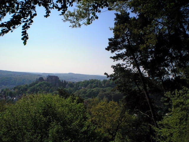
Für alle die meinen Marburg sei flacher als die Niederlande ;-)

eine sehr schöne Runde um Marburg.

Die Route führt stellenweise über verwilderte Wege und Passagen die schwer zu fahren sind – Notfalls schieben ! Zwei Treppen sind auf dem Weg zu überwinden – ist aber schnell gemacht.

Viel Spaß beim nachfahren.

Galeria trasy

Mapa trasy i profil wysokości

  • Open Street Map
  • Google
Minimum height 157 m Maximum height 378 m Widok szczegółowy

More about the tour author

Heinrichs
Member since 2007

Send private message

Komentarze

Am Besten auf http://maps.google.de/maps?hl=de&tab=wl den Startpunkt

 N49 55.983 E7 38.435 einkopieren und sich eine Wegbeschreibung raussuchen


GPS tracks

Trackpoints
  • GPX / Garmin Map Source (gpx) download
  • TCX / Garmin Training Center® (tcx) download
  • CRS / Garmin Training Center® (crs) download
  • Google Earth (kml) download
  • G7ToWin (g7t) download
  • TTQV (trk) download
  • Overlay (ovl) download
  • Fugawi (txt) download
  • Kompass (DAV) Track (tk) download
  • Karta trasy (pdf) download
  • Original file of the author (gpx) download

More about the tour author

Heinrichs
Member since 2007

Send private message
Share track
Add to my favorites
Remove from my favorites
Edit tags
My score
Rate
Trasa: Marburger LH Konditionsfahrt
Rodzaj: Rower górski (MTB)
Długość: 32,2 km
Evaluated on:
Czas trwania:
Day(s)
Hour(s)
Minute(s)
Ocena: Krajobraz Czynnik zadowolenia Kondycja Technika